I Bombed Pearl Harbor Exhibit
This interactive exhibit tells the story of the December 7, 1941, Japanese attack on Pearl Harbor which precipitated America’s entry into WWII.
The story is presented in a fresh and timely way using vintage maps, documents, ephemera and artifacts from Japan and America, as it looked from both the American and Japanese perspective.
The primary materials date from the 1930s and 1940s,
and includes many original items that are rarely seen.
Curated by The Story of Hawaii Museum Exhibit & Gallery Bryant Neal, Chief Curator and Pear Harbor Historian.
Reserve your exhibit date and for more information contact Bryant Neal at bryantneal808@gmail.com | 808.283.3576
Commemorative merchandise to be sold.
Dec. 7, 2026, is the 85th anniversary of the Japanese attack on Pearl Harbor which precipitated America's entry into WWII and one of the costliest, hard fought, volatile and protracted military engagements of the 20th century. Perhaps no story has been told more often, more fervently, and because the United States won the war, it has almost always been told exclusively from the American point of view.
But now, with the passing of time and the cooling of emotions, it is possible to discern that there is another side to that story, a side that is mostly unknown and untold either to Americans or to Japanese living today.
It's a story of a long-standing bi-polar relationship between the two countries which dates back to July 8, 1853, when American Commodore Matthew Perry led his four ships into the harbor at Tokyo Bay, seeking to re-establish for the first time in over 200 years regular trade and discourse between Japan and the Western world. It's a story that swings back and forth between two nations as they grow and change and emerge as world powers.
In the mid 19th century, both countries were bit players on the global stage, but as time progressed these two strong willed and ambitious nations cast each other in a variety of roles that see-sawed from trusted ally to hated adversary and back again to ally in the 21st century scheme of things.
But most importantly it is a story that both countries have taken some pains not only to ignore but also to suppress.
The occasion of the 85th anniversary of the attack on Pearl Harbor is the ideal opportunity to take a fresh and wider ranging view of events leading up to World War II and the role played by each nation in an exhibition that can be understood and appreciated not only by the generation that survived the war but its children, grand-children and great-grandchildren alive today.
85th Memorial Observance of
The Bombing of Pearl Harbor
Pearl Harbor Aerial Combat Photography
Curated Sets of Attack Images
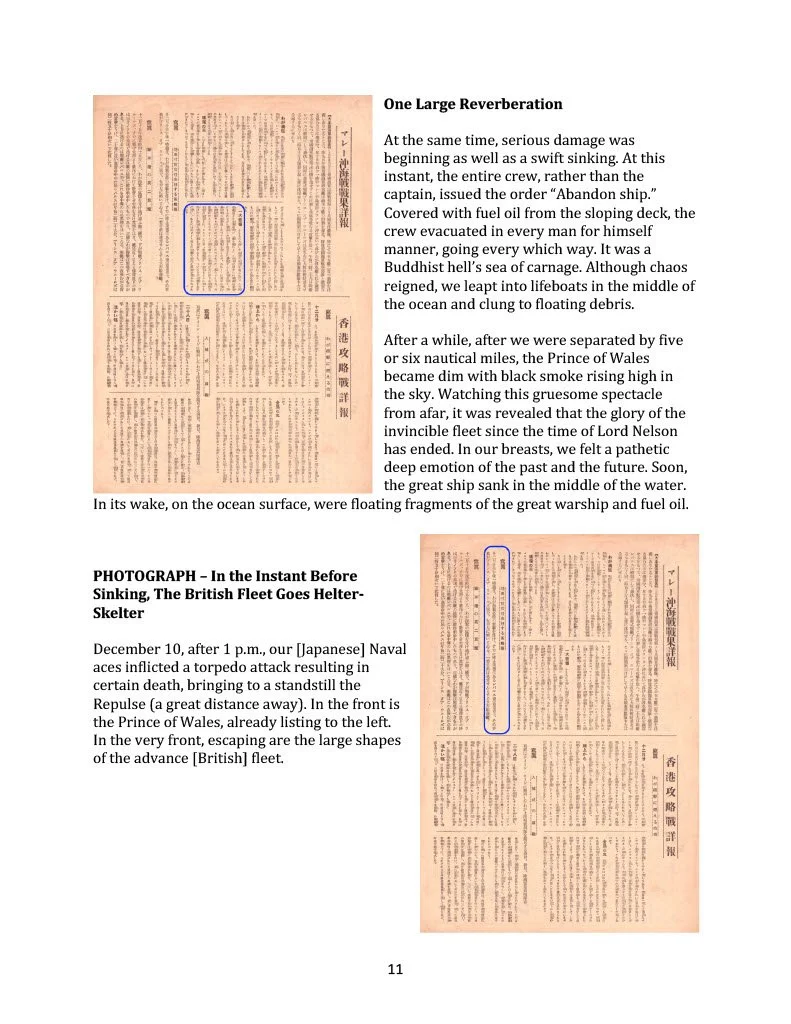
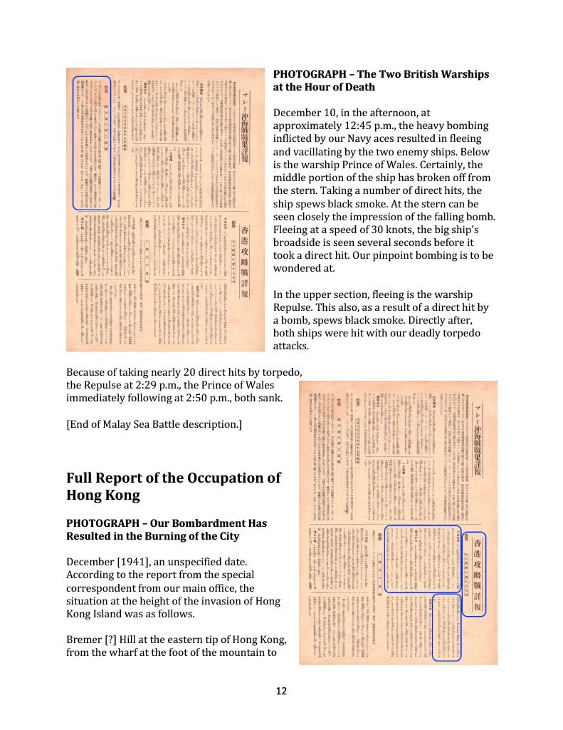
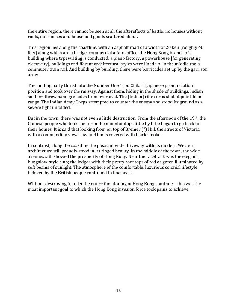
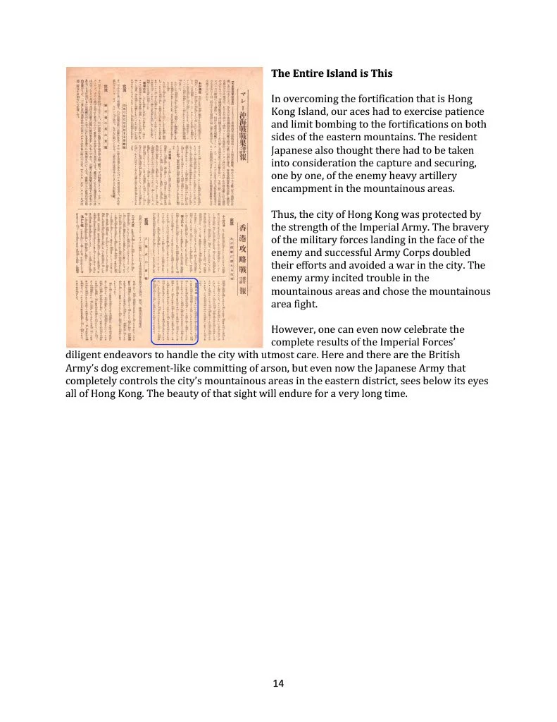
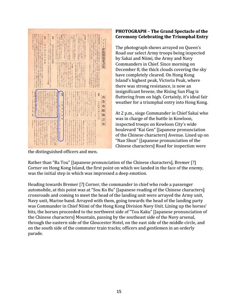
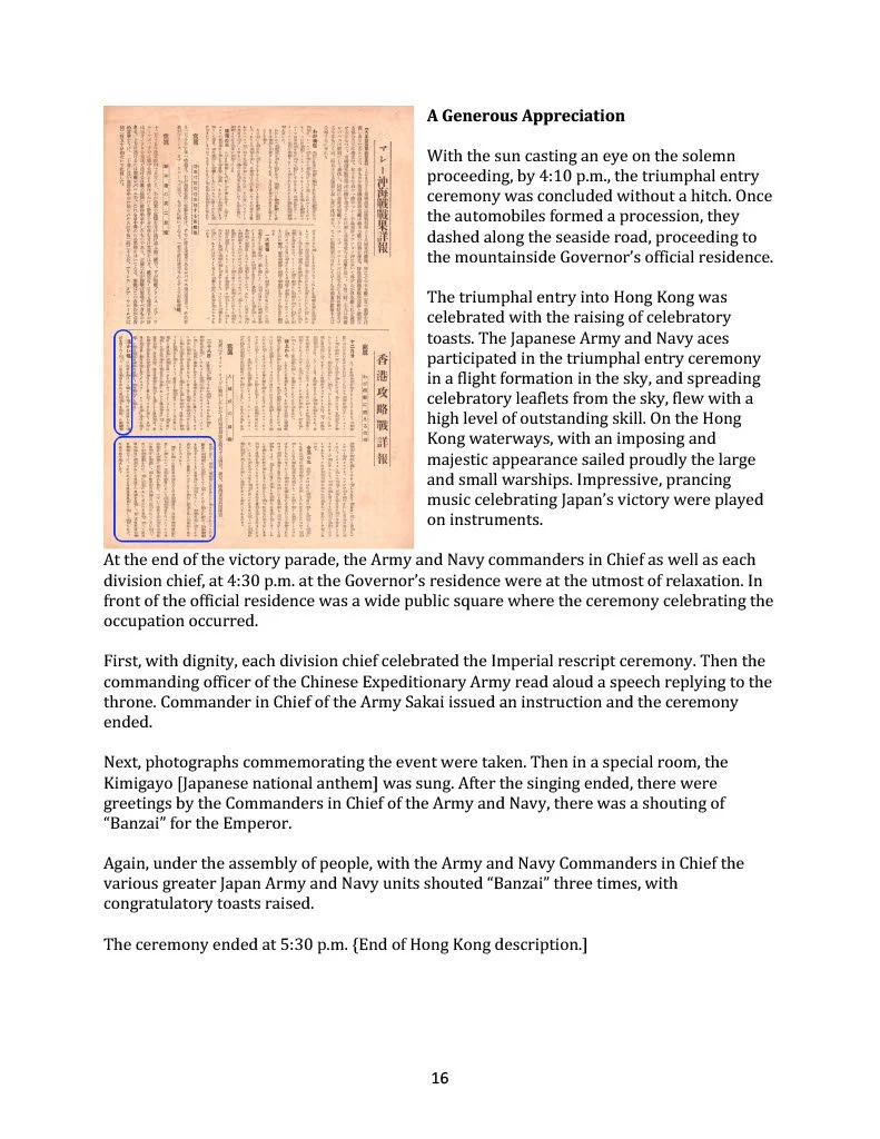
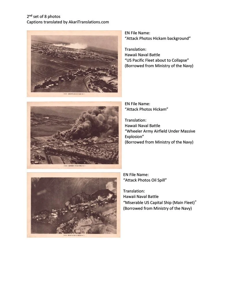
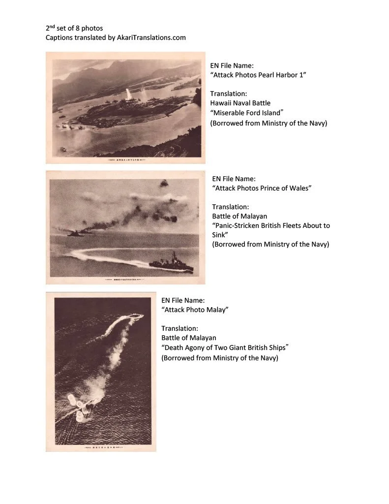
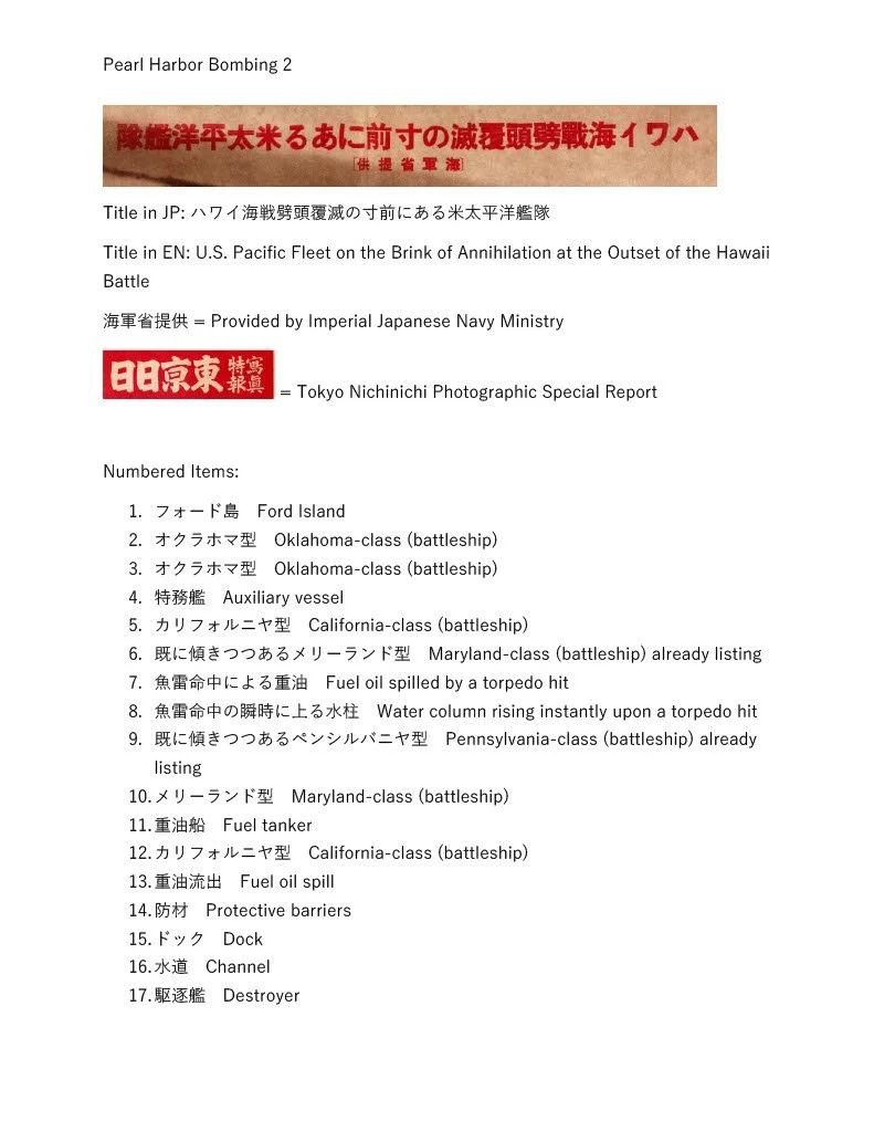
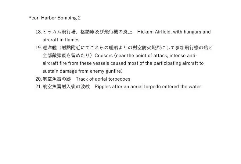
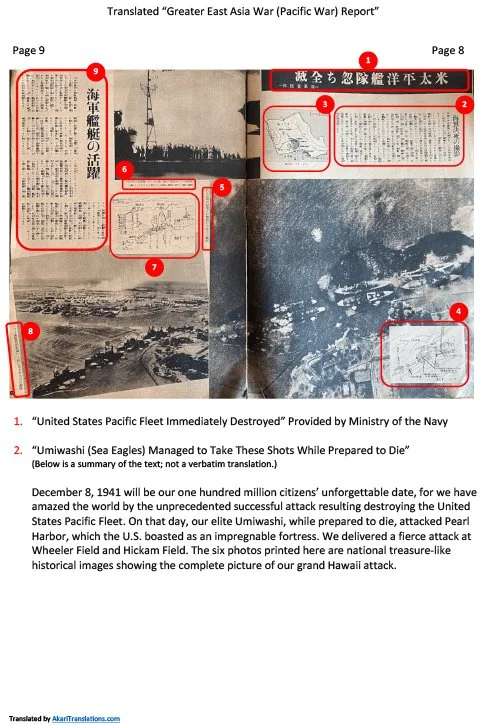
The Japanese government provided a detailed account of its victory over the US at Pearl Harbor, the British in Malaya and Hong Kong. Packaged sets of war images were made from photographs taken by Japanese pilots to document the damage.
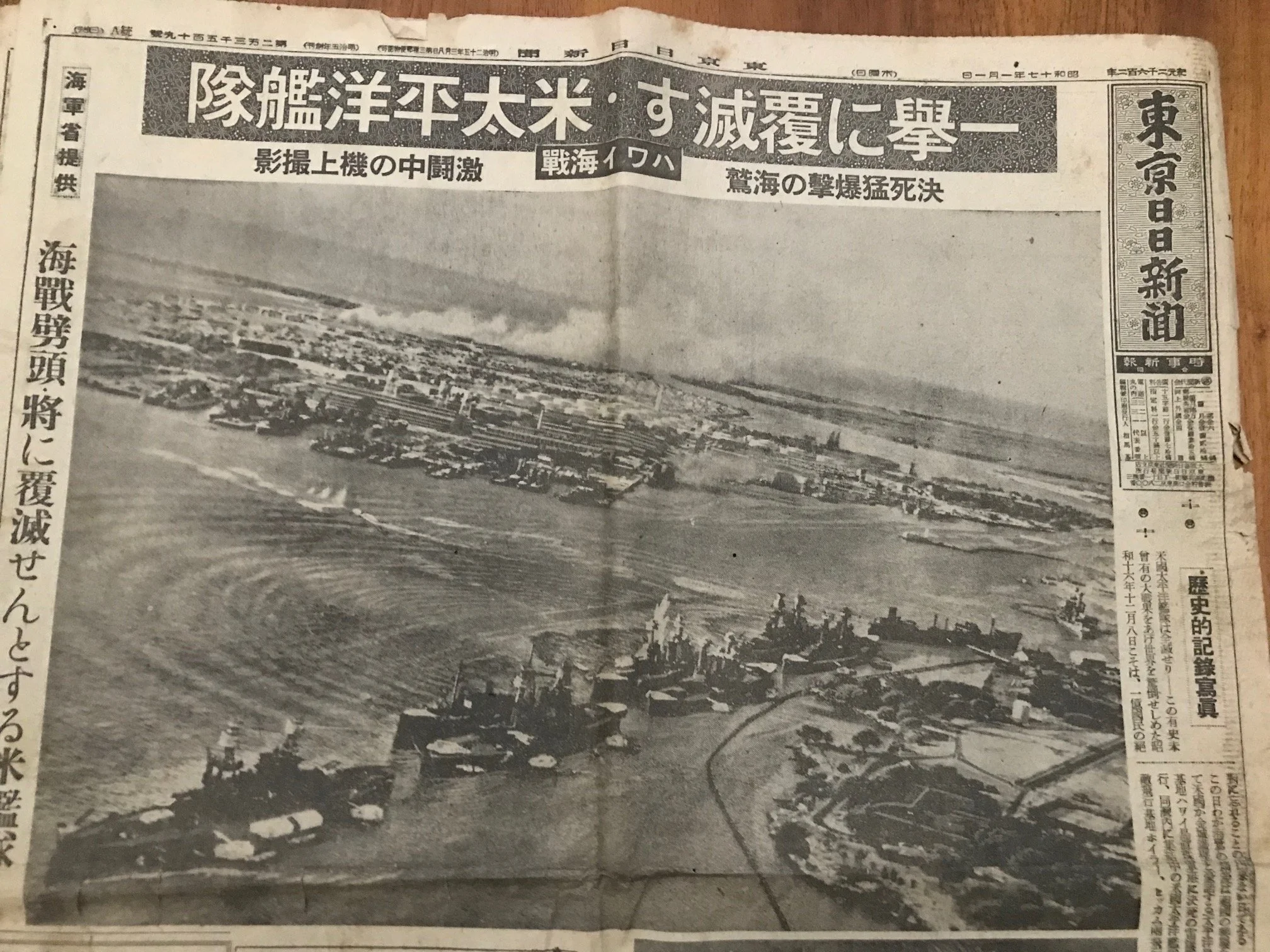
As part of the attack on Pearl Harbor, Japanese naval aviators in planes equipped with high powered cameras, took hundreds of pictures capturing the actual bombing sequence.
These images were used as powerful propaganda tools in Japanese media to inform citizens about the Pearl Harbor attack, showcase the military's success, bolster national pride and rally support for the war effort.
Of the hundreds of photos taken, approximately 8 key images passed censorship and were approved for public viewing.
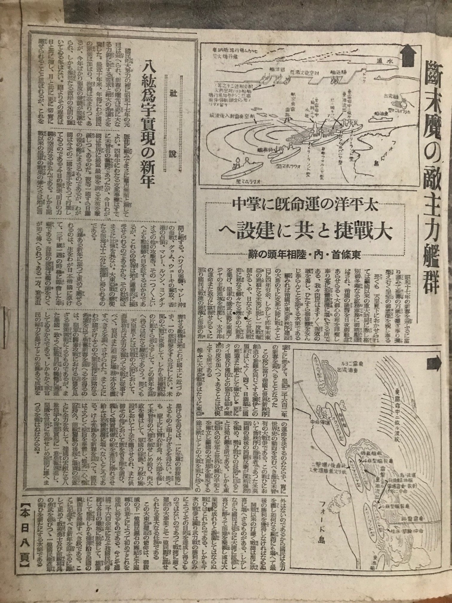
The chosen images were packaged and circulated in Japanese media through Newspapers, post cards, stamps, special edition sets, staged news reels and propaganda films.
If you were a Japanese citizen in 1941, these were the images used by government officials to inform you about the bombing of Pearl Harbor.
The main theme of the exhibit is showcasing examples of how these images were used in each of the forementioned categories.
Historic Photographic Record of Complete Destruction of Entire American Pacific Fleet
Cover Page Translation
1. Top line (on the top of a large box)
The United States of America
2. Second and third line in the larger box:
Historic Photographic Record of Complete destruction of entire American Pacific Fleet
3. Fourth line (on the right – vertical)
As presented by the Navy
4. 5th line: (on the left – vertical)
Eight photos as a set for 30 cents
5. Fifth box: (smaller center box over the
large box)
Fantastic Naval Battle of Hawaii
6. Sixth box: (larger box under the 5 the boxes)
The world shaking, never before heard of, surprise attack “Pearl Harbor’’. Photos taken from the plane by our courageous flyers! The full pictures of the Naval station, Pearl Harbor, and the scenes of black smoke covered column of American Pacific Fleet by the attack of our Navy. This set of photos is an important record in the history of the Pan-Pacific War, to be treated as a National Treasure.
7. Under the box 6:
(Credits) Tokyo NichiNichi Shimbun-sha / Osaka Mainichi Shimbun-sha
8. Bottom lines (Outside the decorative frame)
(Postal credits) Post office approved code numbers for the above two Newspaper companies.
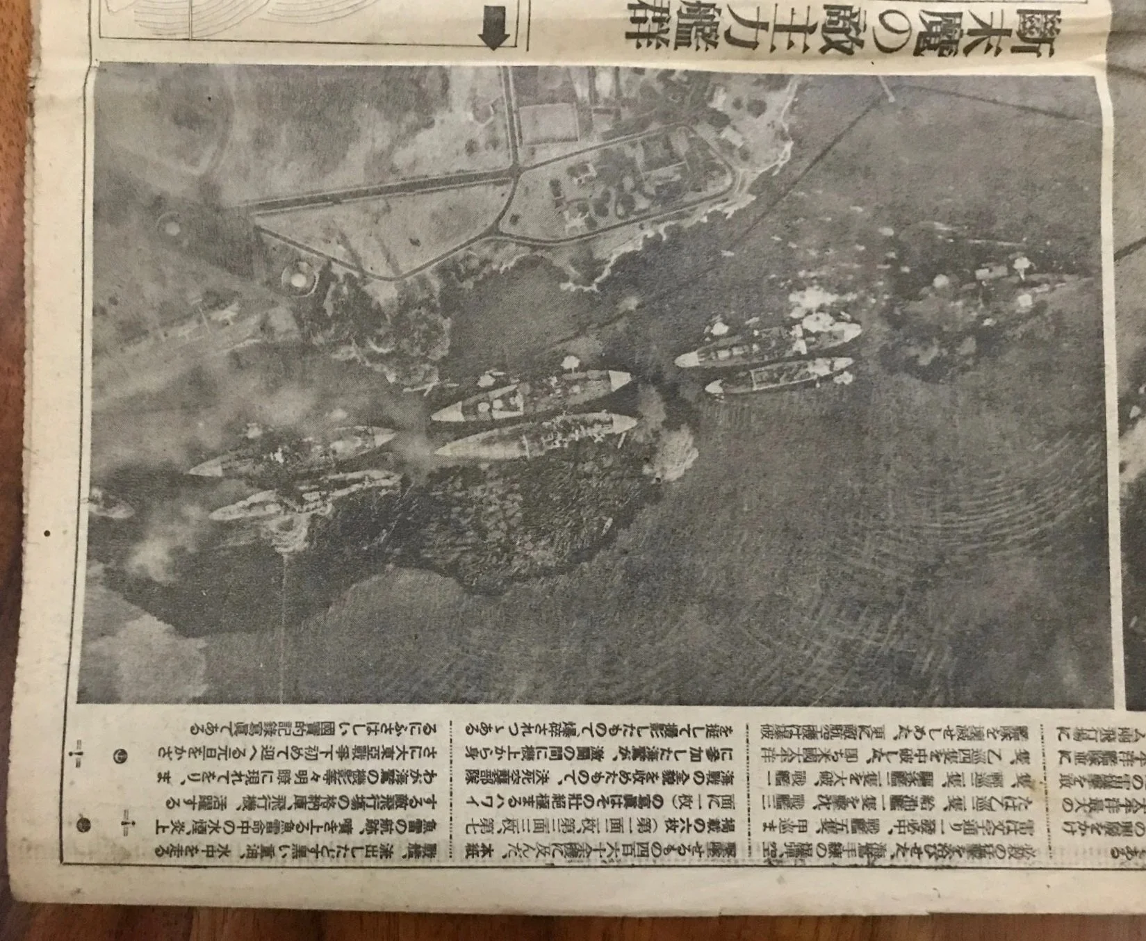
1. About to be destroyed entire American Pacific Fleet. All their major battleships are lined up in the front view. The shining white shadow in the ocean is one of our onrushing torpedo boats. Some of the enemy warships were seen as being hit already and are on the careen. Seen also the white smoke cloud is rising from the Hickam Air Base.
Tokyo Nichinichi Shimbun/f Mainichi Shimbun
2. Perspective view of the enemy’s major fleet and its battleships. The tall cloud of spray is rising from the Battleship Oklahoma, hit by torpedo. 4 ships in front on left are their cruisers. Two of our Navy aircrafts are in the view.
Tokyo Nichinichi Shimbun/Mainichi Shimbun
3. The scene of the end of American fleet. The top of this photo is the already hit and sank the Battleship Oklahoma by our torpedo and the second Oklahoma-type of warship was hit also. The third ship, the battleship California-type of ship was hit on the starboard and badly damaged. The bottom left of the picture, a Maryland-type of battleship was hit and badly damaged.
Tokyo Nichinichi Shimbun/ Mainichi Shimbun
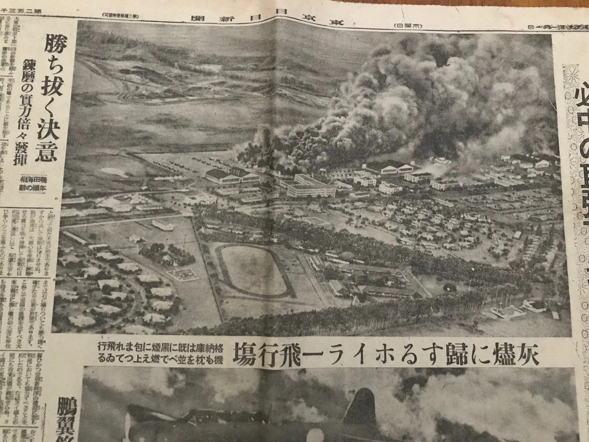
4. The Wheeler Army Airbase under attack. Seen neatly lined up fuel tanks on the right and the airbase’ runways. The black smoke cloud is covering the harbor.
Tokyo Nichinichi Shimbun/ Mainichi Shimbun.
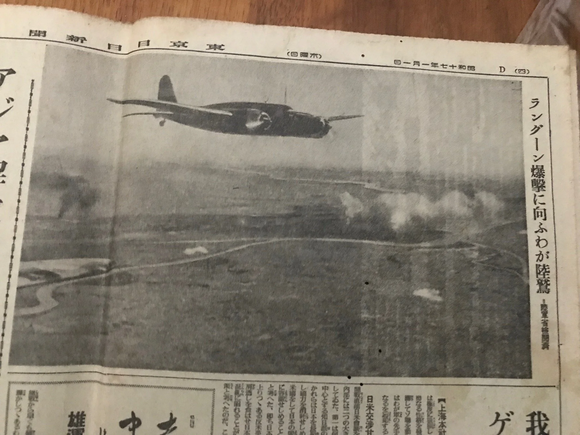
5. Our bombers are flying over the Pearl Harbor. The entire enemy fleet in the harbor is covered by the black smoke.
See the Hickam Army Airbase on the lower half of thephto.
Tokyo Nichinichi Shimbun/Mainichi Shimbun.
6. Perspective view of Pearl Harbor. The white spays are from the Battleship Oklahoma.
Tokyo Nichinichi Shimbun/Mainichi Shimbun.
7. By the fierce attack of our Navy Air Force, the Wheeler Airbase in Hawaii was covered by a dense black cloud. All their hangers are already smoke filled and their proud aircrafts are about to be destroyed in flames.
Tokyo Nichinichi Shimbun/Mainichi Shimbun.
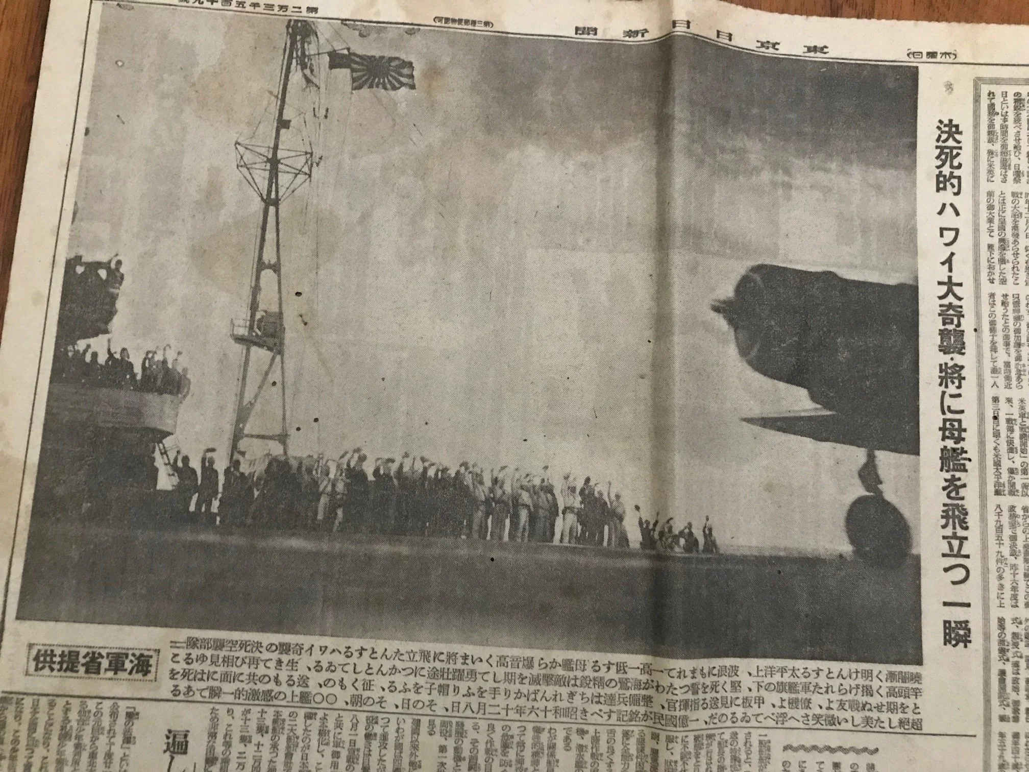
8. Officers and sailors are waiving goodbyes as they are sending off the consort planes in the early dawn of the day of the attack on the deck of XX air-carrier.
Tokyo Nichinichi Shimbun/Mainichi Shimbun.
The Tokyo Nichi Nichi Shimbun (東京日日新聞, Tōkyō Nichi Nichi Shinbun) (lit. Tokyo Daily News) was a newspaper printed in Tokyo, Japan from 1872 to 1943. In 1875, the company began the world’s first newspaper delivery service. In 1911, the paper merged with Osaka Mainichi Shimbun (大阪毎日新聞, lit.
“Osaka Daily News”) to form the Mainichi Shimbun (毎日新聞, lit. “Daily News”) company. The two newspapers continued to print independently until 1943, when both editions were placed under a Mainichi Shimbun masthead.
Pearl Harbor Aerial Combat Attack
Photos and Translations (Set 1)
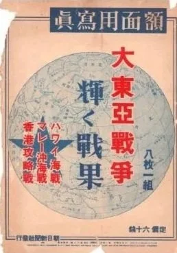
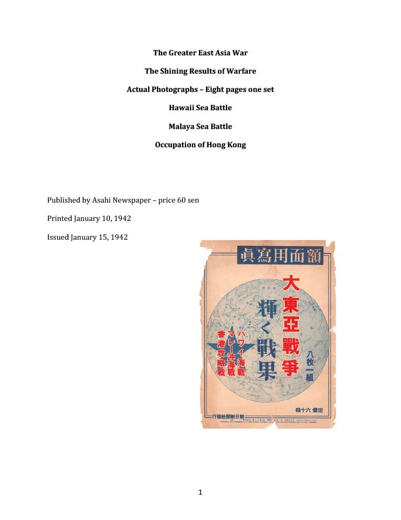
The Greater East Asia War
The Shining Results of Warfare
Actual Photographs – Eight Pages One Set
Hawaii Sea Battle
Malaya Sea Battle
Occupation of Hong Kong
(Set 2)
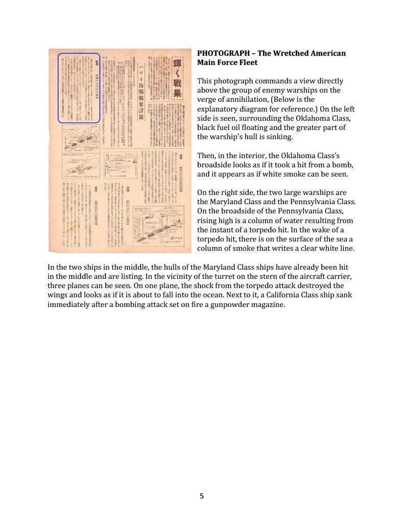
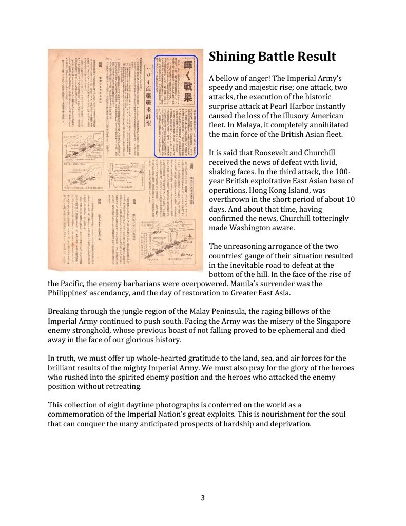
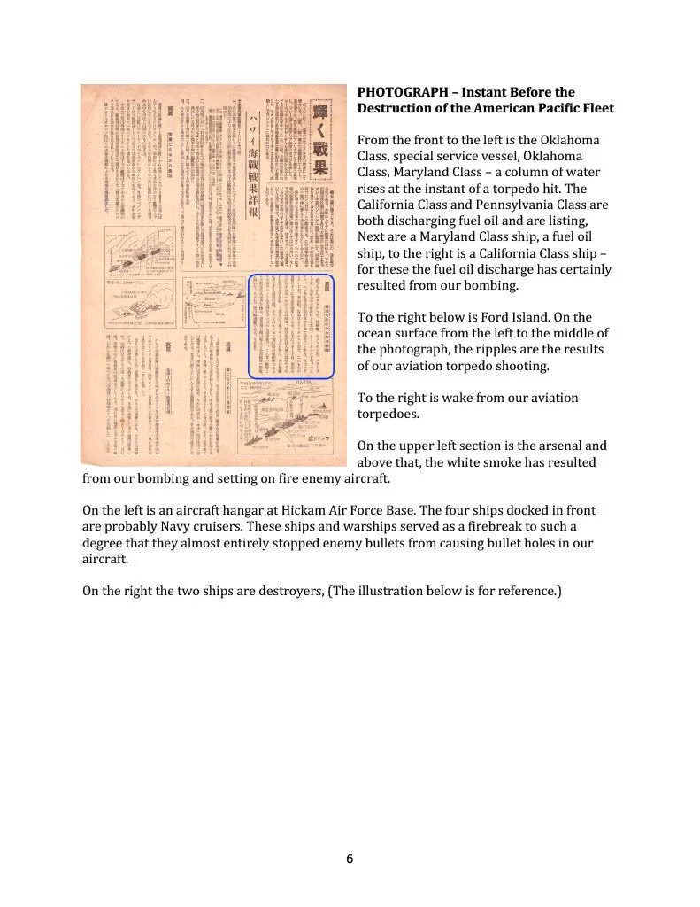
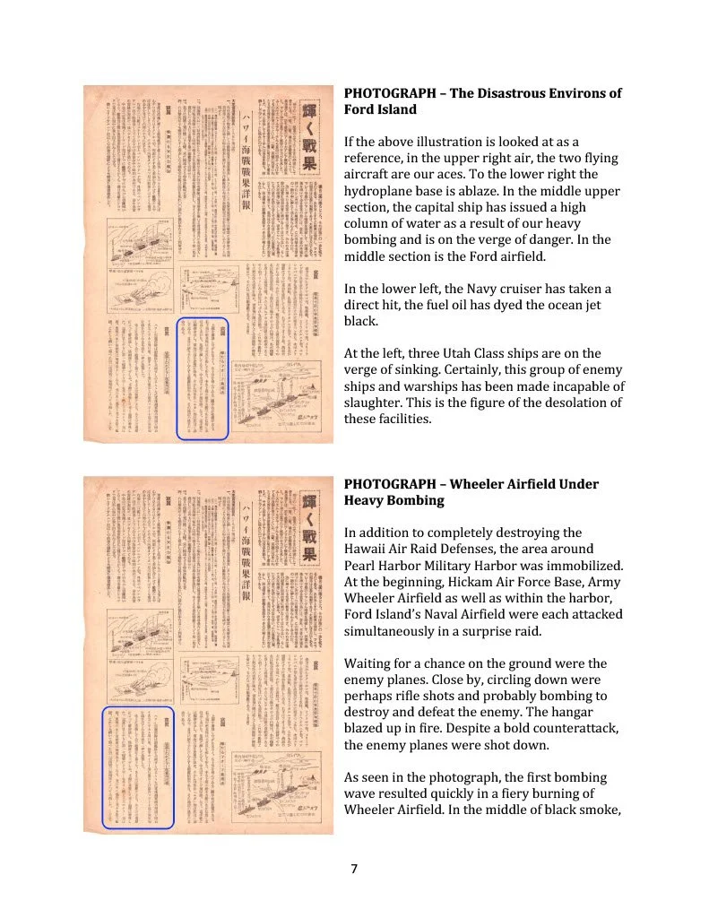
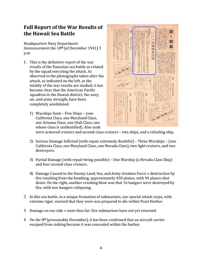
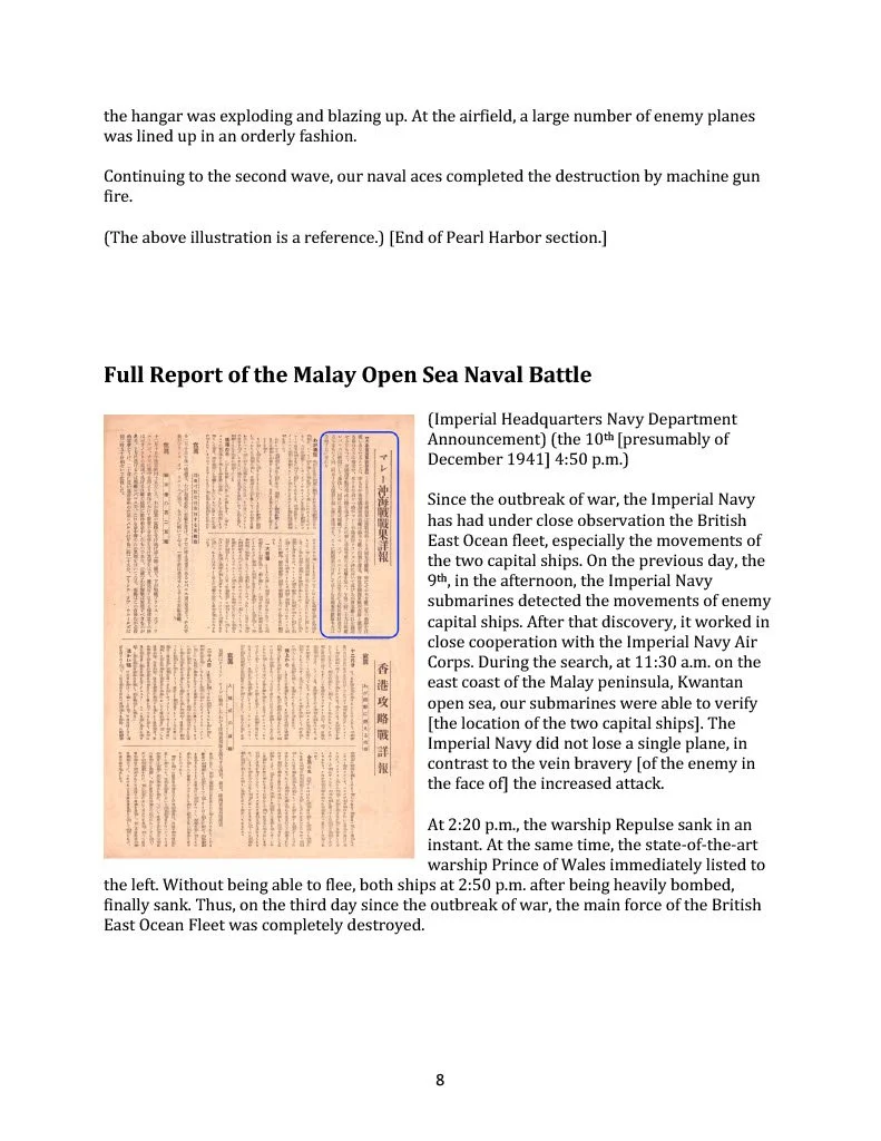
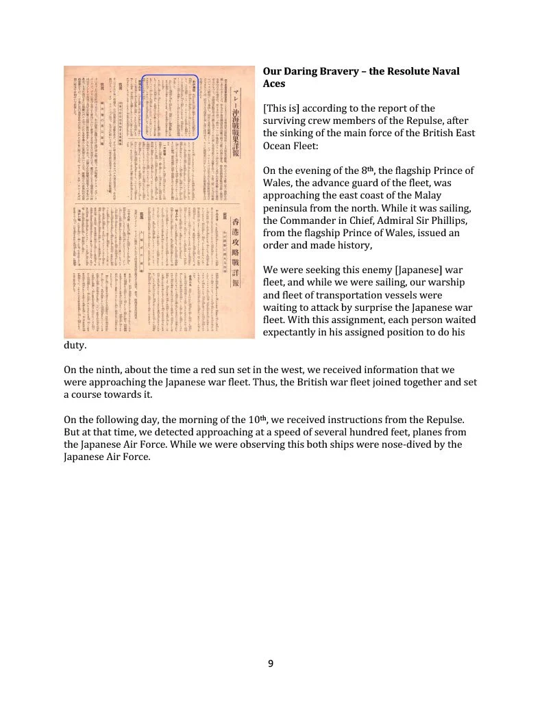
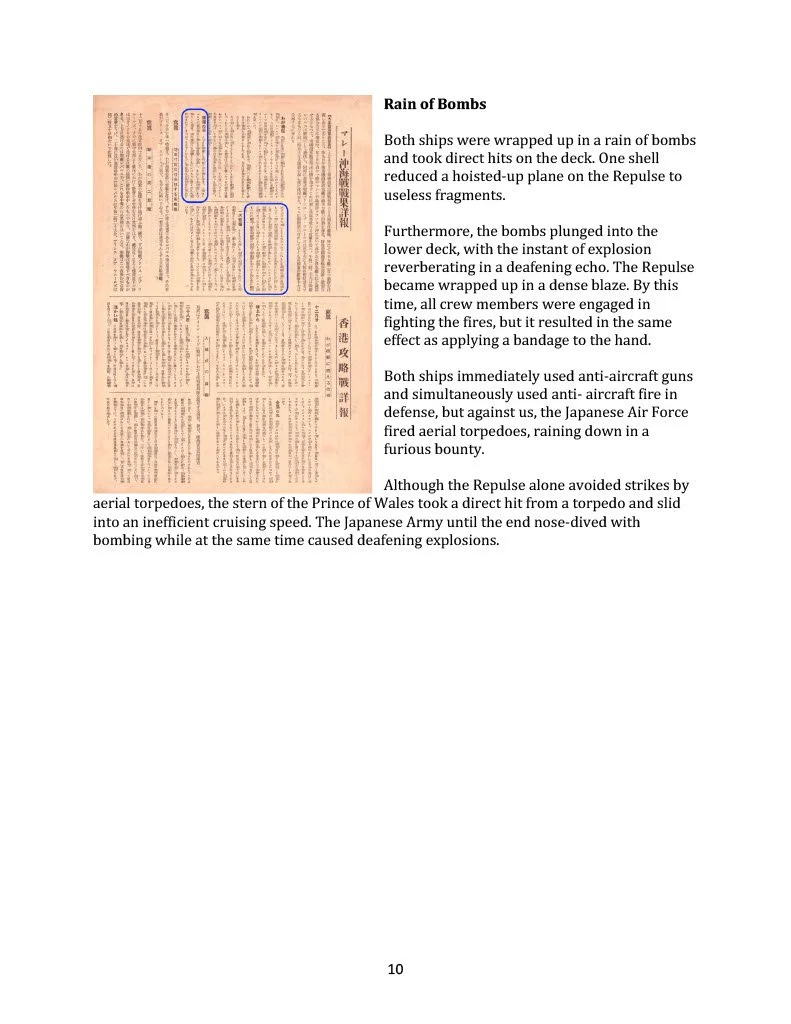
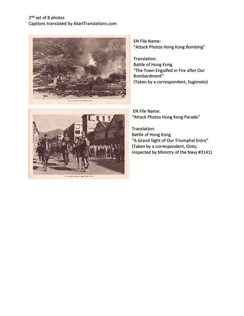
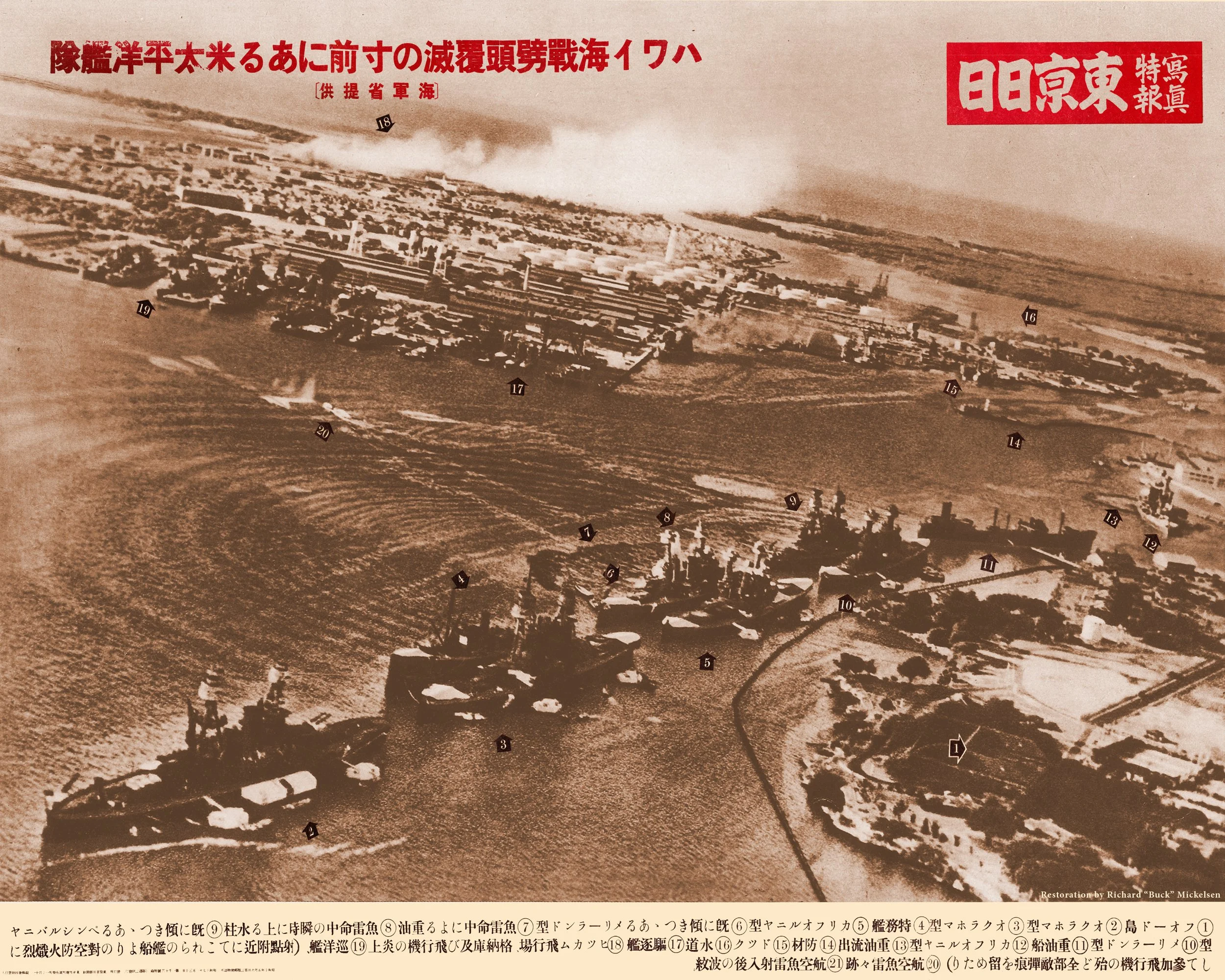
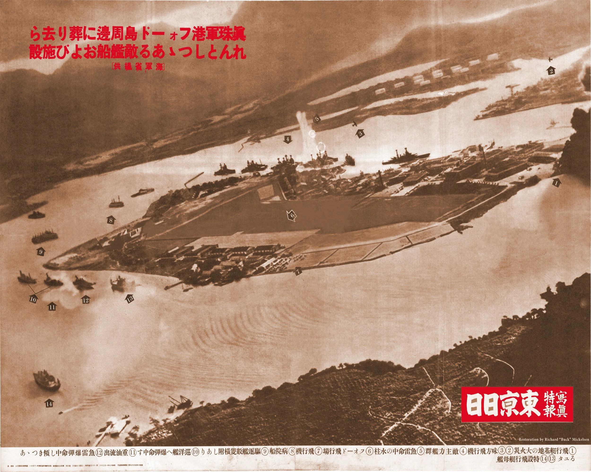
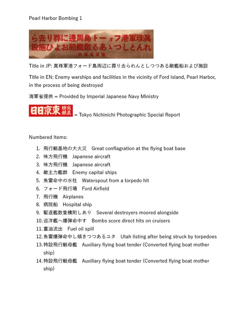
Japan used maps in media reports and official displays to graphically illustrate the success and strategic significance of the Pearl Harbor attack. These maps served as powerful propaganda tools to rally public support for the war effort.
Japan's wartime "government meeting maps" were large-scale, (approx. 31" x 41") authoritative visual aids used by officials to communicate the strategic and economic goals of the Greater East Asia Co-Prosperity Sphere to the public. These maps were specifically designed for display at mandatory community gatherings and government briefings (tonarigumi or neighborhood association meetings). They were intended to be visible to large crowds in public halls or community centers to justify the war effort by emphasizing regional resource wealth.
Additionally, government representatives used these maps to:
Demonstrate Self-Sufficiency: Compare the resource-rich "New Order in East Asia" against the "materialistic" Western colonial powers to show that Japan could survive and thrive without Western trade.
Highlight Military Success: Point to specific newly "liberated" territories (like the Philippines or Dutch East Indies) to show the tangible benefits of military victories.
World War II Maps of The Pacific
1931 Manchurian Incident Map
This important chart titled “Night of September 18, Battle Summary Near North Garrison’ was published by the Kwangtung Army HQ and printed by the South Manchurian Printing Co.
The map measures 15 ¼ x 21 ½.
The Mukden Incident, or Manchurian Incident, was a staged event engineered by rogue Japanese military personnel as a pretext for the Japanese invasion in 1931 of northeastern China, known as Manchuria. This incident was similar in impact to China as the bombing
of Pearl Harbor was to the USA.
On September 18, 1931, Lt. Suemori Kawamoto detonated a small quantity of dynamite close to a railway line owned by Japan’s South Manchuria Railway near Mukden (now Shenyang). The explosion was so weak that it failed to destroy the track and a train passed over it minutes later, but the Imperial Japanese Army accused Chinese dissidents of the act and responded with a full invasion that led to the occupation of Manchuria, in which Japan established its puppet state of Manchukuo six months later.
Map translations:
North Garrison located right below the title. Scale 1:10,000
Japanese Soldiers approximately 600; Chinese soldiers approximately 8,000 – 10,000
near the North Garrison.
Top left description:
Red ink – Japanese soldiers’ position and movement
Blue ink – Chinese soldiers’ position and movement
Red Cross at mid bottom is the exact location of railway explosion done by the Chinese
BOTTOM RIGHT: Inset of Mukden City.
Japan Prepares for War
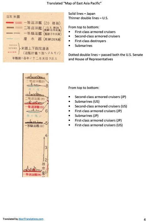
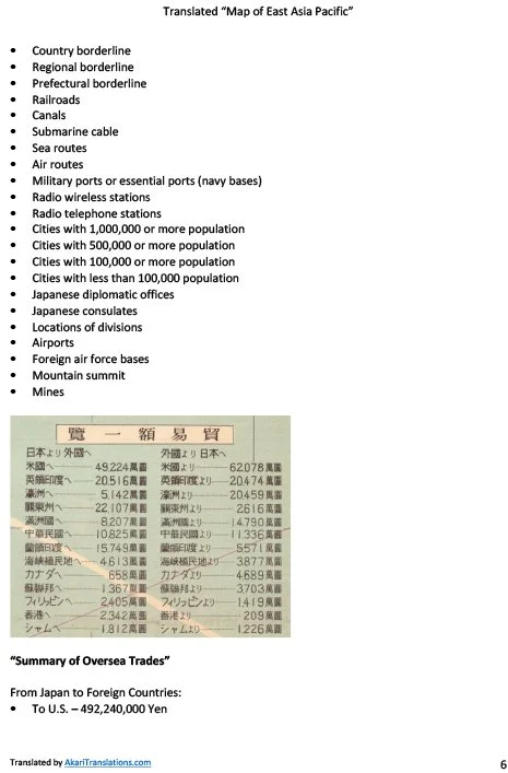
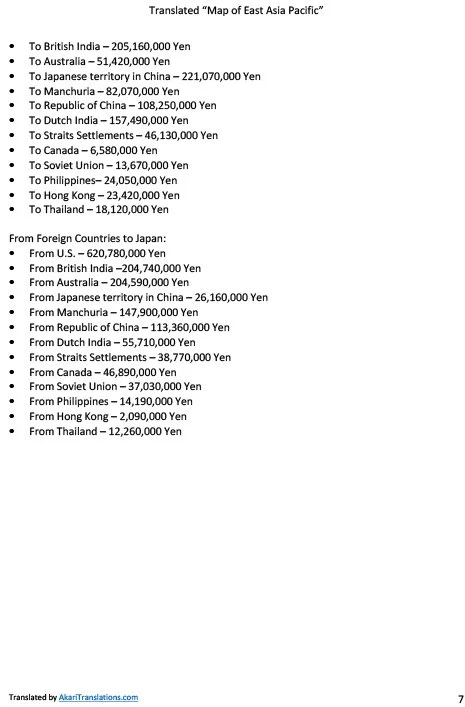
1934 Map of East Asia Pacific
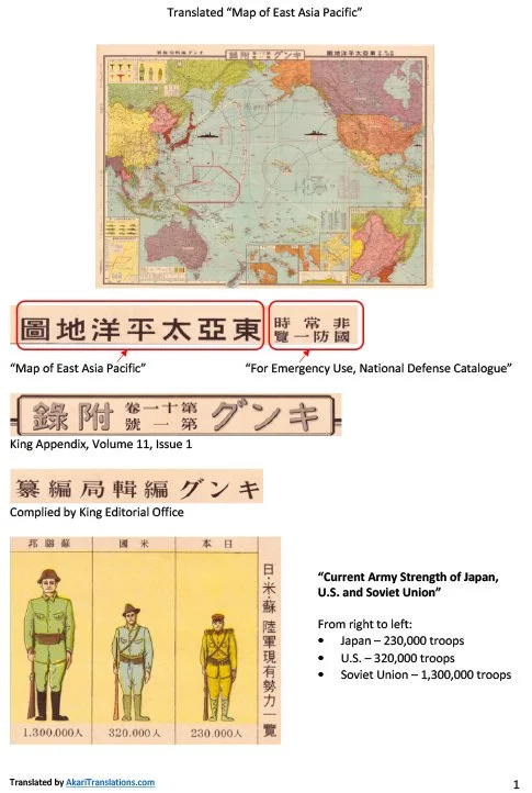
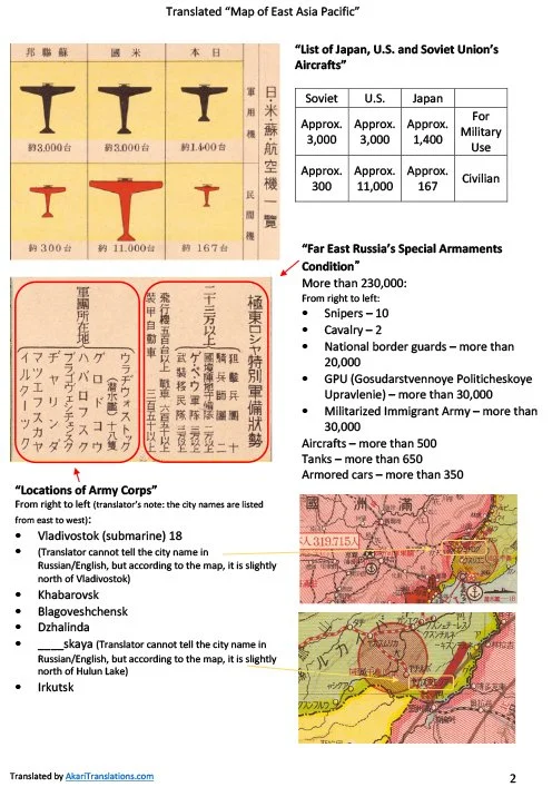
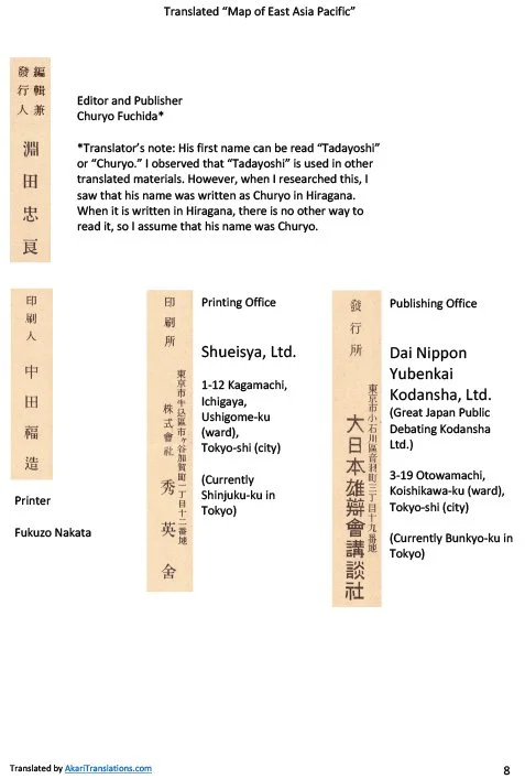
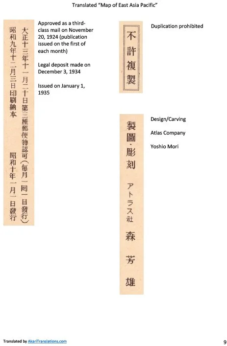
This map was printed December 3, 1934 (SHOWA 9) and published January 1, 1935 (Showa 10) by the "GREAT JAPAN DEBATE SOCIETY" a right-wing organization before WWII. KING MAGAZINE supplement issue, 11th Volume. Map measures 31 x 43 inches.
The publication of the 1934 "Map of East Asia Pacific" exposes a highly detailed, pre-meditated calculation of geopolitical and military strength that directly aligned with Japan's eventual strategy during the Pearl Harbor attack
and the wider Pacific Theater.
Sizing Up the Competition
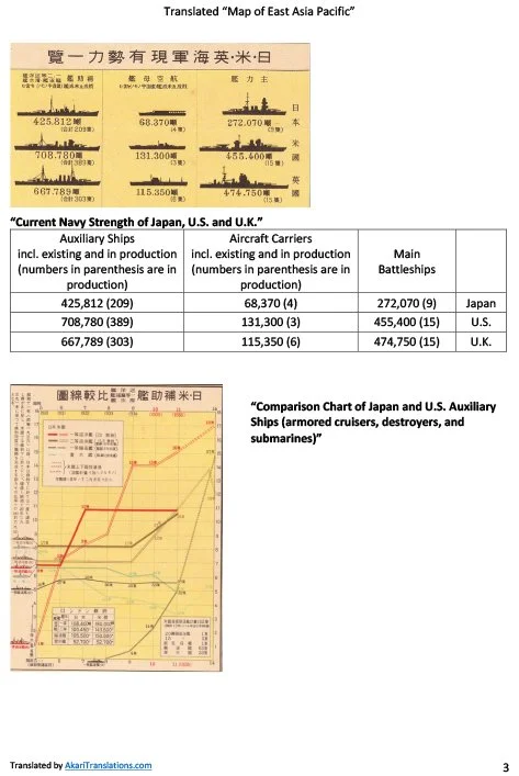
Years before open hostilities broke out, this map served as a comprehensive "sizing up" of the military might of Japan’s primary rivals: the United States and the Soviet Union in size of army, navy and air force.
Blueprint for the Pacific Strategy
The physical geography and specialized insets map out the exact chess board of the Pacific War:
The Target Insets: By highlighting hyper-specific locations like the Hawaiian Island chain, Honolulu Harbor, and Pearl Harbor alongside vital American gateways like San Francisco Harbor and the Panama Canal, the map highlights the exact choke points Japan needed to monitor or neutralize to prevent a quick U.S. counter-offensive.
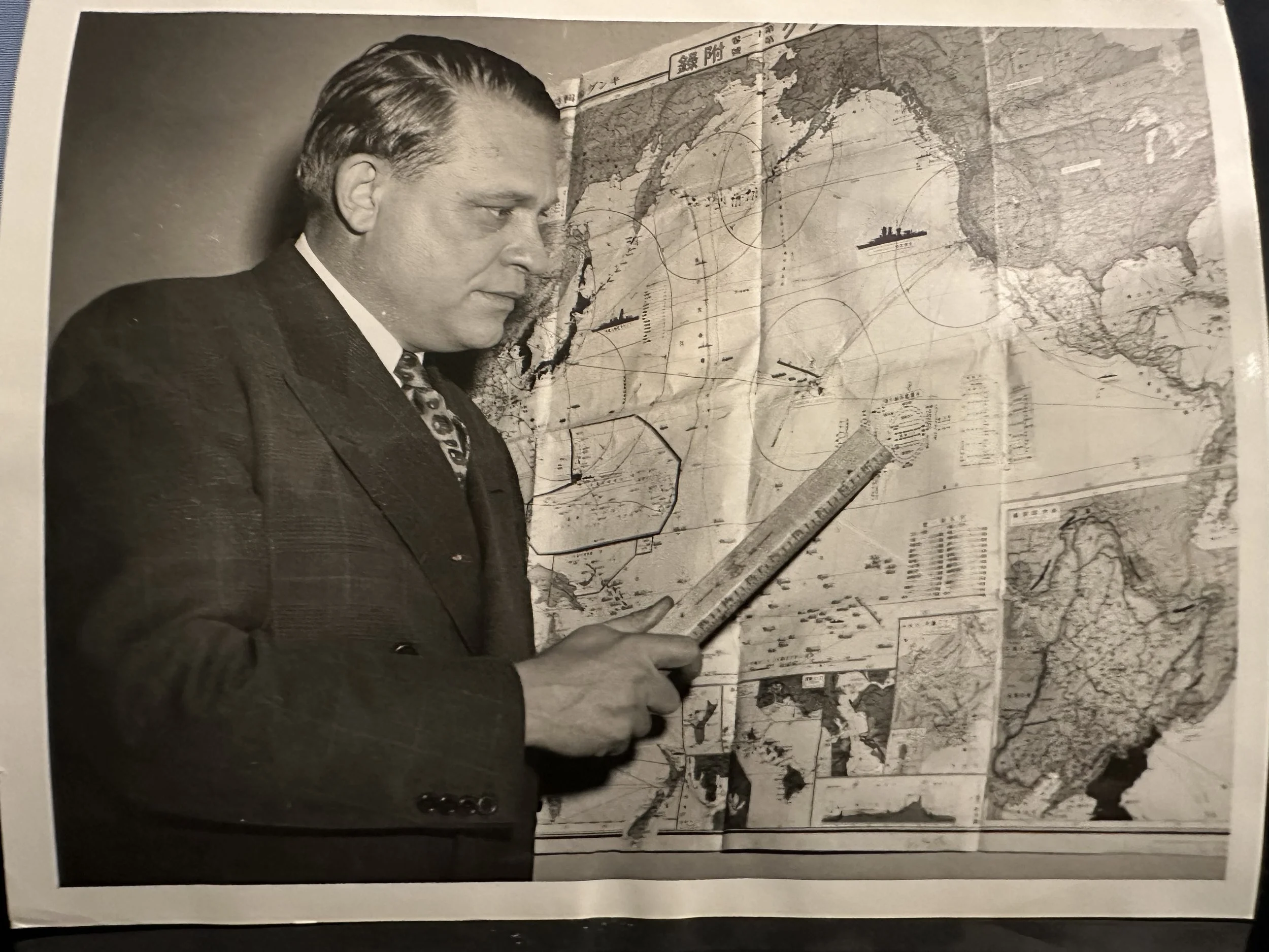
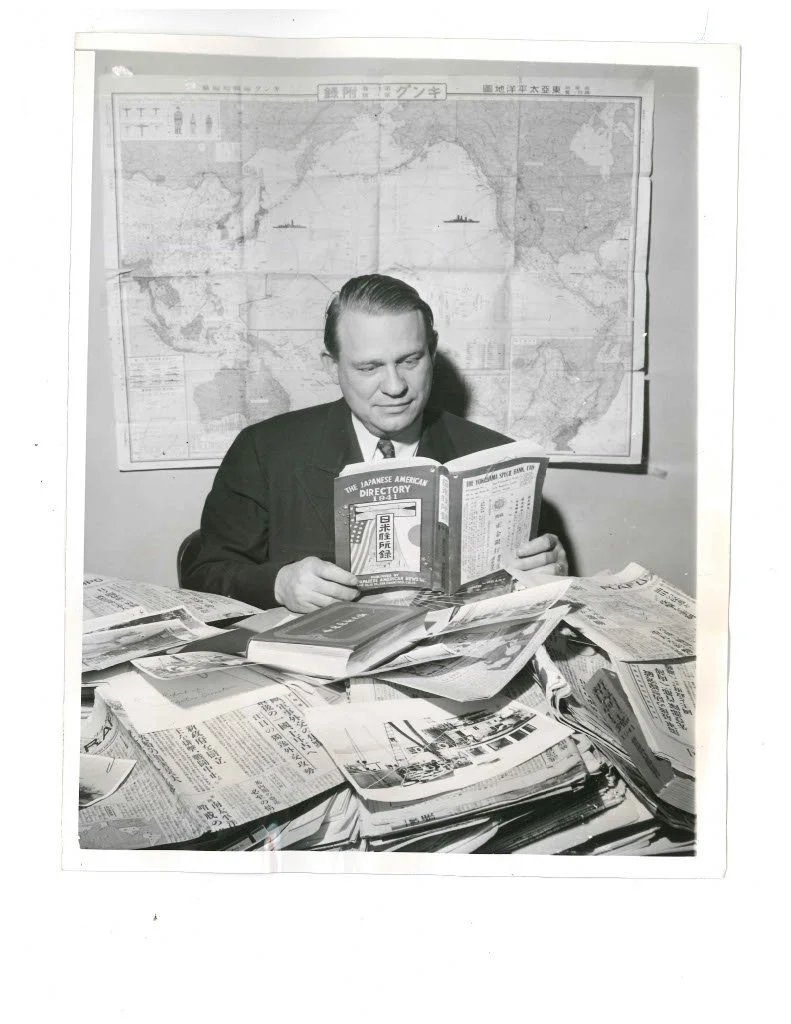
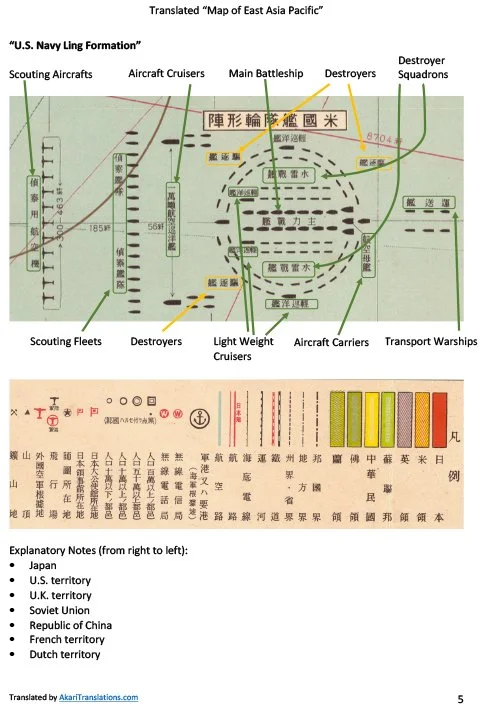
U.S. Fleet Formations: The inclusion of a detailed "U.S. Navy Ring Formation" diagram reveals that Japanese intelligence was actively studying American naval doctrine. Understanding how the U.S. structured its scouting fleets, screening destroyers, and main battleship cores allowed Japanese planners to tailor their torpedo and dive-bomber tactics to maximize devastation during the December 7, 1941, raid. (see Rep Dies press photo)
Ultimately, this map reveals that Japan's sweep across the Pacific was not a collection of ad-hoc decisions, but the execution of a deeply studied, mathematically modeled strategy that had been openly organized and visualized nearly
a decade before the first bombs fell on Pearl Harbor.
The Dual-History Provenance (The "Dies" Connection)
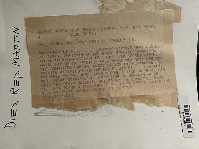
In addition to its geographic attributes, what elevates this map above almost all other Japanese ephemera of the 1930s is its recognition as a piece of American wartime political history. Famously seized by Congressman Martin Dies’ agents during the frantic West Coast raids of 1942, it became a political weapon used on the floor of the U.S. Congress to fuel wartime panic, secure committee funding, and build the public case for Japanese American internment.
When Representative Martin Dies showcased this map to the American public in 1942, its ultimate importance became clear: it was the smoking gun that proved Japan's sweeping offensive across the Pacific was not a desperate, spur-of-the-moment reaction to the 1941 oil embargoes, but a cold, calculated grand strategy that had been openly visualized and taught to its population since 1935.
The map revealed alarming evidence to Representative Martin Dies and the U.S. military regarding Japan’s early preparedness, mindset, and long-term intentions, even though it was published nearly seven years before the Pearl Harbor attack. [1]
When Representative Dies’ committee seized the map and publicized it in February 1942—just months after Pearl Harbor—they highlighted it as "convincing proof of Japan's belligerent intentions."
-
![Black and white photograph of a man in a suit examining a large map pinned to the wall, with various routes, geographic details, and ships depicted.]()
Press Photos showing representative Martin Dies viewing the 1934 map obtained under extraordinarily difficult circumstances.
-
![A brown paper document with typed text, taped to a white surface with masking tape, includes references to Japs and Pearl Harbor, with handwritten notes on the side.]()
-
![A black and white photo of a man in a suit sitting at a cluttered desk reading a book, with a world map on the wall behind him. There are numerous newspapers and magazines spread across the desk.]()
Press Photos showing representative Martin Dies viewing the 1934 map obtained under extraordinarily difficult circumstances.
-
![Close-up of a classified document with typed and handwritten notes, and a blue stamped seal.]()
1937 Illustration of the Recent
East Asia State of Affairs Map
“Illustration of the Recent State of Affairs of East Asia”
Osaka Mainichi Shinbun, January 1, 1937
This Japanese newspaper map presents East Asia on the eve of the Second Sino‑Japanese War. It highlights troop numbers, airfields, railways, and borders while portraying Japan as a peaceful stabilizing power surrounded by hostile neighbors—China and the Soviet Union—and misunderstood by Western nations. Manchukuo, the Japanese‑controlled state in Manchuria, is depicted as a legitimate “brother country,” and Chinese resistance is labeled as terrorism and foreign‑inspired agitation.
Far from a neutral map, this image is a piece of visual propaganda. It helped ordinary readers see expansion into China and the defense of Manchukuo as necessary acts of self‑protection. The sense of encirclement and grievance expressed here would deepen over the next four years, shaping the strategic choices that ultimately led Japan to attack Pearl Harbor on December 7, 1941.


1937 World Situation and National Defense Map
Issued on January 1, 1937, showing the power projection of the Imperial Japanese Navy including Carrier Akagi near Hawaii.
During the 1930s, the Japanese Navy began construction of airfields, fortifications, ports, and other military projects in the islands controlled under the South Pacific mandate, viewing the islands as “unsinkable aircraft carriers” with a critical role to play in the defense of the Japanese home islands against potential American invasion.
These became important staging grounds for Japanese air and naval offensives in the Pacific War.
Kwajalein was a major base supporting the attack on Pearl Harbor and the Battle of Wake Island
Palau supported the Battle of the Philippines
Saipan supported the Battle of Guam
Truk became the base for amphibious landings on Tarawa and Makin in the Gilberts, as well as Rabaul, in the Australian mandate Territory of New Guinea
Majuro was used in air strikes against Howland Island
Jaluit Atoll was the base from which the Japanese Navy seized Nauru and Ocean Island
In addition to the islands’ naval importance, the Japanese Army utilized the islands to support air and land detachments. The “island-hopping” strategy employed by the United States military caused the Japanese Empire to lose control of its Pacific possessions between 1943 and 1945.
By 1937, Japan had annexed territory north of Beijing and following the Marco Polo Bridge Incident, a full-scale invasion of China began.
Japan’s intention to acquire resource-producing colonies in the Pacific and Southeast Asia would likely lead to confrontation with the United States, thus the U.S. became Japan’s primary potential enemy.
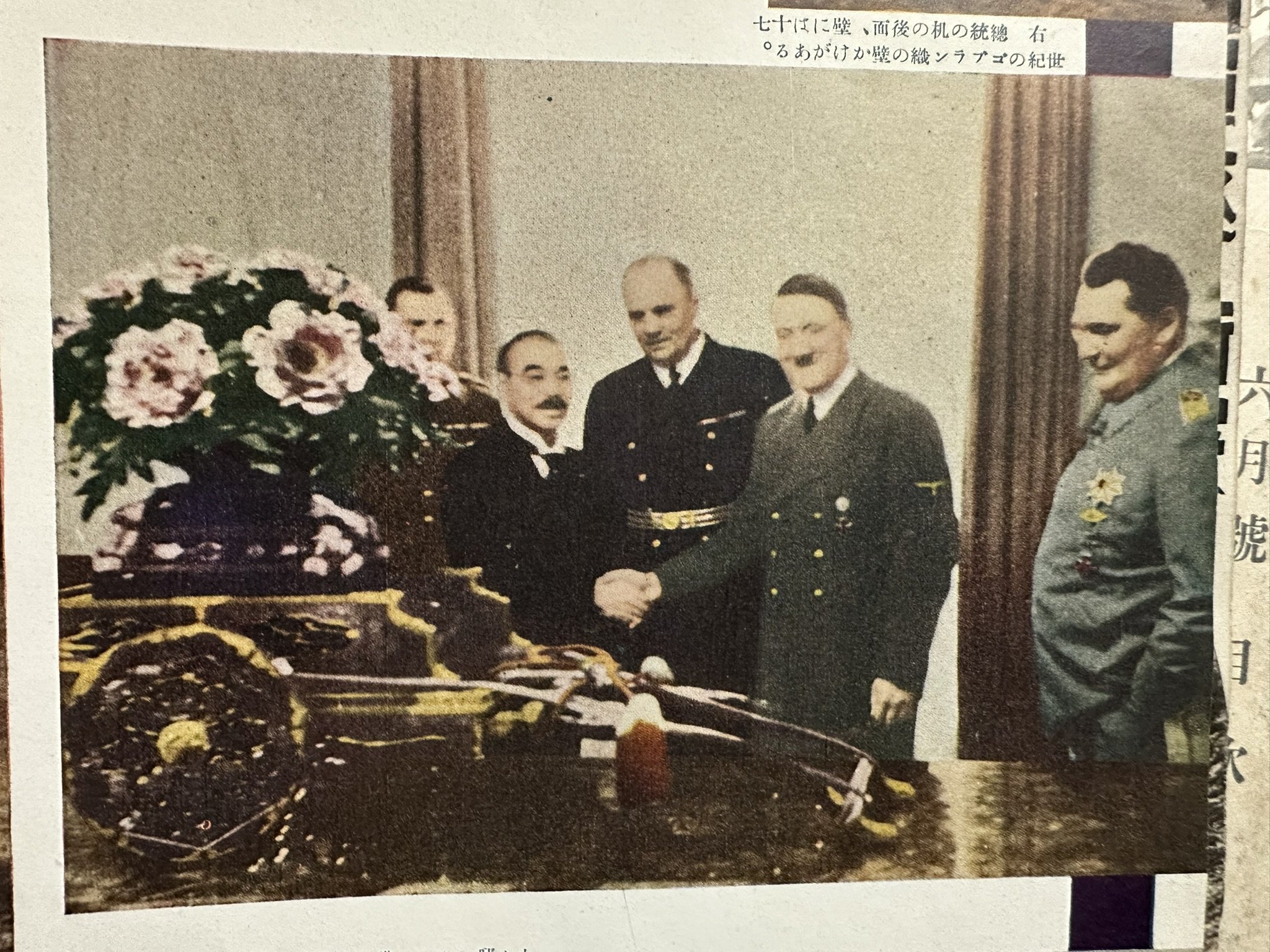
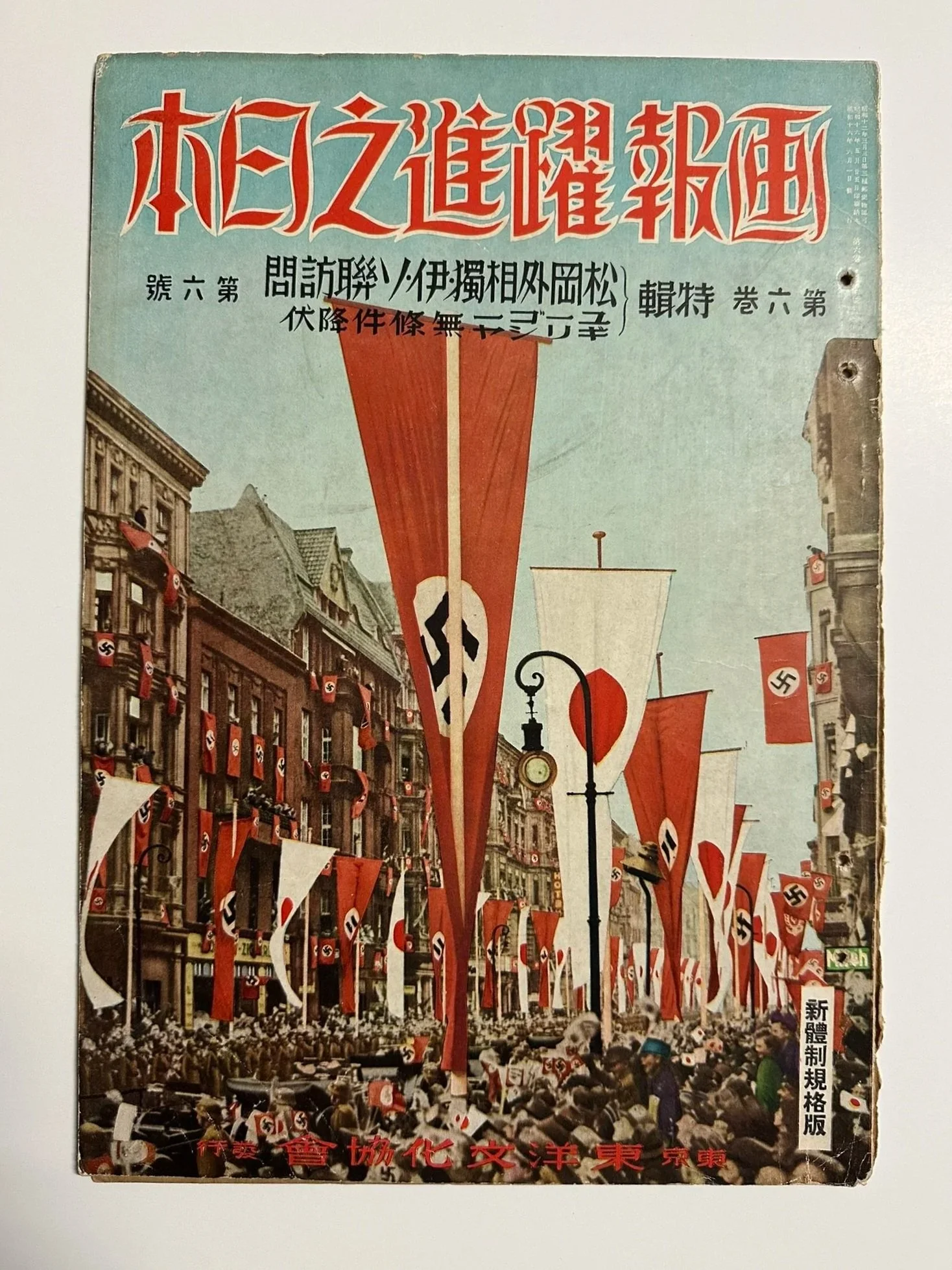
1941 Tripartite Map
THE MOST RECENT DETAILED MAP OF THE WORLD
This map acknowledges the Tripartite alliance between Japan, Italy and Germany.
The flag of Japan is shown with Germany and Italy on both sides.
Printed: Showa-16 (1941) June 15
Published: Showa-16 (1941) June 20
153th edition
Illustrator: Junichi Kizaki
Publisher: Hideharu Ibayashi
58 Kami-Kurumazaka-cho, Shitaya-ku, Tokyo
Printer: SHUBI-DO Printing Co., Ltd.
1-6 chome, Tamura-cho, Shiba-ku, Tokyo
Tel (43) 2276/ 0237
MAIN AREA OF EUROPE
Publisher: Ibayashi Book Store
58 Shitayaku, Kami Kurumazaka-cho, Tokyo
Transfer Account No. 666658
Tel: (87) 3725
Inset
MAIN AREA OF EUROPE
Inset
ANTARCTIC
Land mass
Designated area
ANTARCTIC EXPEDITION ROUTES
Nob Shirase (Japanese)
Rods (?)Amun
dsen (Roald Amndsen: Norwegian)
Scott (Capt. Robert Scott: UK)
Shackleton (Sir Earnest Shackleton: UK)
-
![Historical photograph of five men standing around a presentation table with potted plants and fruit, possibly gift offerings, in a room with a plain wall and curtain in the background.]()
-
![A vintage Japanese magazine cover featuring a street scene sharply decorated with Nazi swastika flags and banners during a parade or protest, with crowd members and historical advertising signage.]()
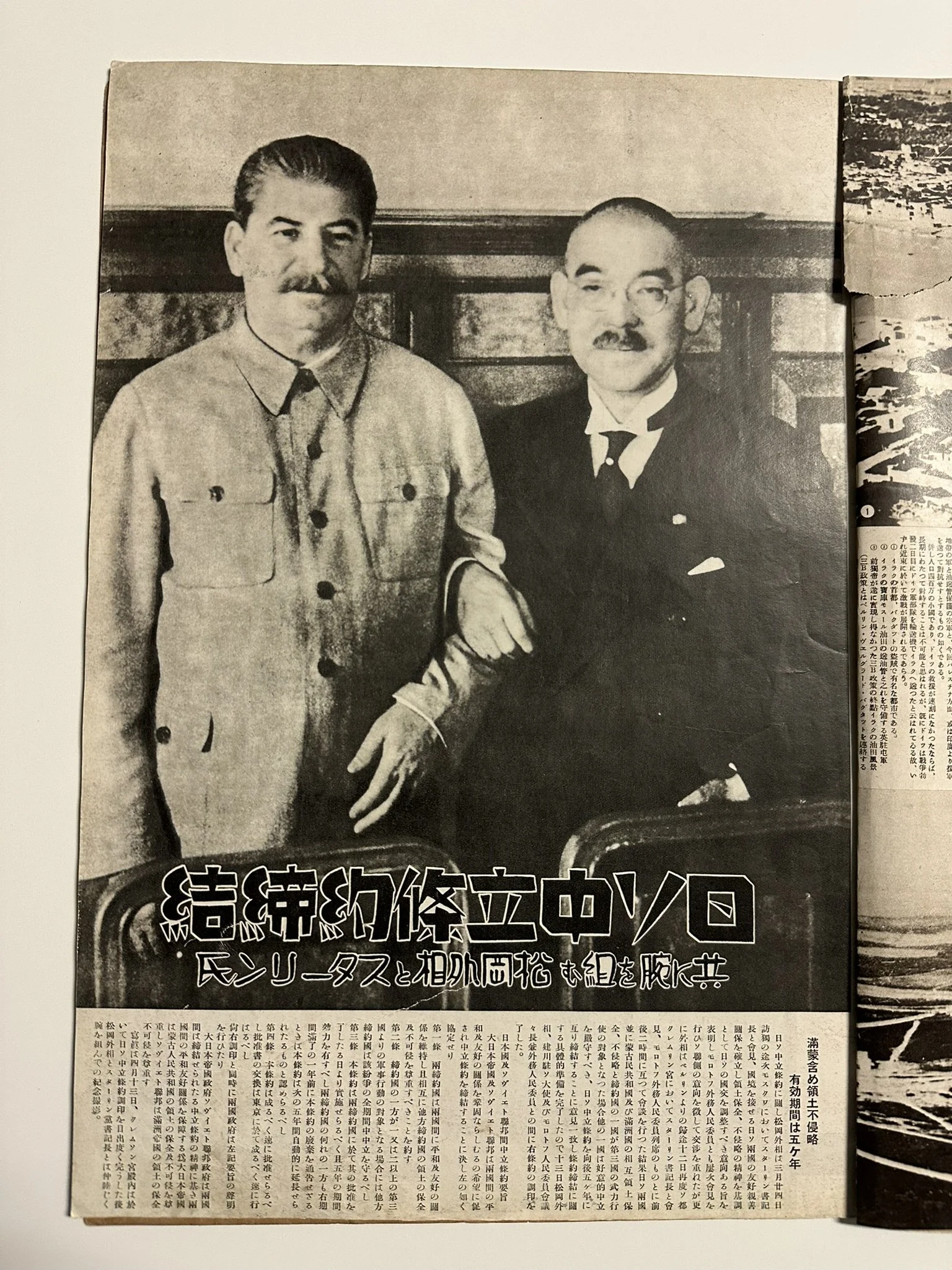
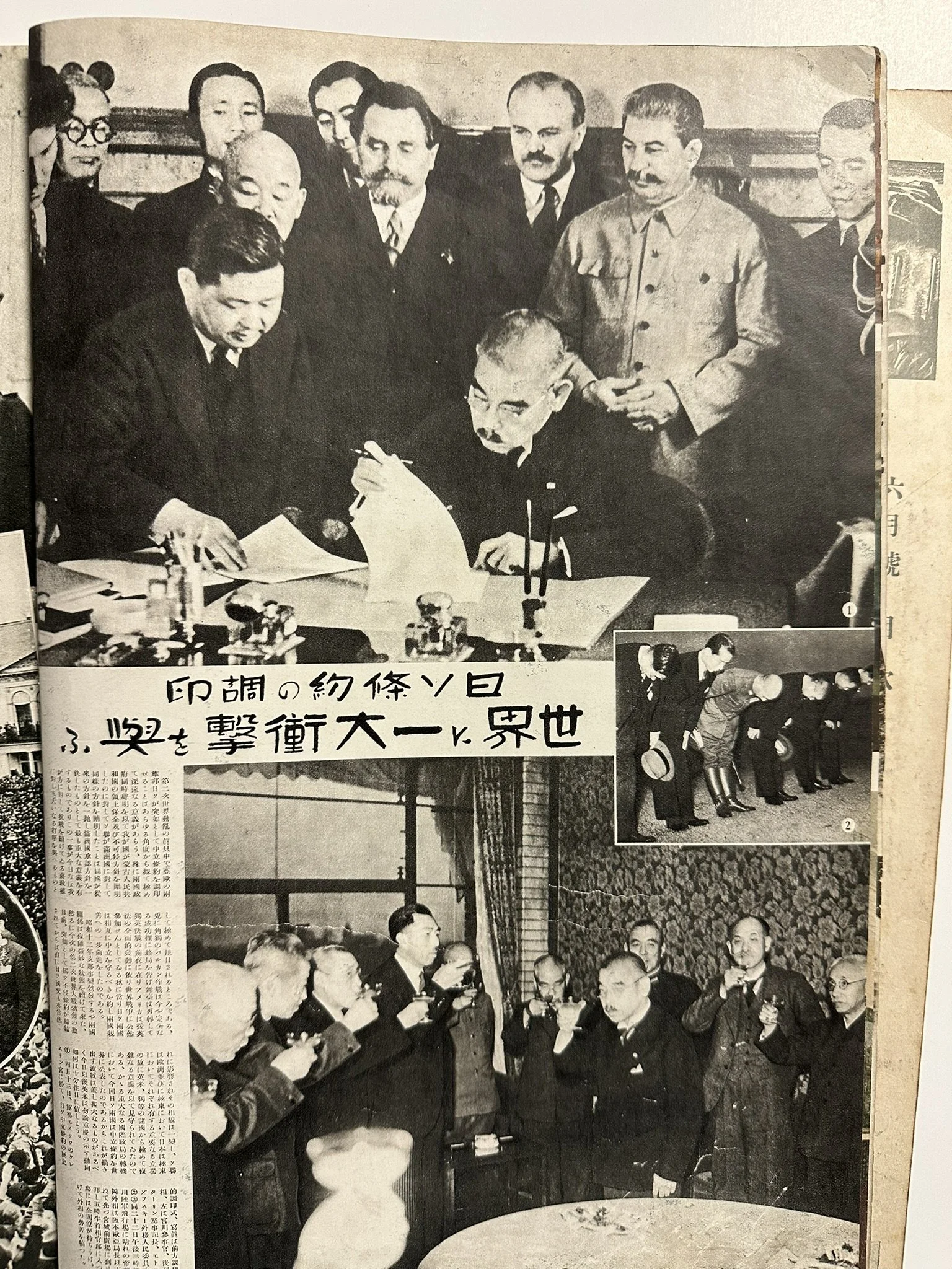
1940 Tripartite
-
![A black-and-white photograph of two men, possibly from Japan, dressed formally, with Japanese text underneath.]()
-
![Historical black and white photograph of a signing or agreement event involving officials and military personnel, surrounded by onlookers, including many in formal attire and some in military uniforms, with Japanese text on the bottom]()
Japan's Wartime Government Meeting Maps
Japan's wartime "government meeting maps" were large-scale, (approx. 31" x 41") authoritative visual aids used by officials to communicate the strategic and economic goals of the Greater East Asia Co-Prosperity Sphere to the public. These maps were specifically designed for display at mandatory community gatherings and government briefings (tonarigumi or neighborhood association meetings). They were intended to be visible to large crowds in public halls or community centers to justify the war effort by emphasizing regional resource wealth.
Additionally, government representatives used these maps to:
Demonstrate Self-Sufficiency: Compare the resource-rich "New Order in East Asia" against the "materialistic" Western colonial powers to show that Japan could survive and thrive without Western trade.
Highlight Military Success: Point to specific newly "liberated" territories (like the Philippines or Dutch East Indies) to show the tangible benefits of military victories.
1942 Map of the Assembled
Greater East Asia Co-Prosperity Sphere
The map was printed June 20, SHOWA 17 (1942) and released on June 25th of the same year. This map was originally for government use only and was not for sale to the public.
During WWII, mandatory community meetings across Japan were requested by the Government to educate the public about the benefits of the Greater East Aisia Co-Prosperity Sphere, consequently large wall maps were printed for this purpose but few survived in decent condition due to their frequency of use, exposure to the elements or destroyed as evidence.
This rare map’s purpose was strictly for government use, and no copies were made available for sale to the public. This is a prime example of the implementation of the Greater East Aisia Co-prosperity Sphere as an instrument of propaganda. At these meetings people were shown all of the members who made up the sphere and the resources they provided for the ultimate benefit of Japan. The map measures approximately 31 x 41 and has been expertly linen backed.
The Greater East Asia Co-Prosperity Sphere (大東亞共榮圏 Dai-tō-a Kyōeiken) was an imperial propaganda concept created and promulgated for occupied Asian populations during the first third of the Shōwa era by the government and military of the Empire of Japan. It extended greater than East Asia and promoted the cultural and economic unity of Northeast Asians, Southeast Asians, and Oceanians. It also declared the intention to create a self-sufficient "bloc of Asian nations led by the Japanese and free of Western powers". It was announced in a radio address entitled "The International Situation and Japan's Position" by Foreign MinisterHachirō Arita on June 29, 1940.
The information in the insets has been expertly translated as follows:
(at lower left) Greater East Asia Co-prosperity Sphere –Comparison of the Populations (figures from right to left)
1) Japan -105,226,000 people (as of 1939)
2) Manchukuo – 36,672,705 people (as of 1937)
3) China (including Taiwan) – 427,507,000 people ( as of 1936)
4) Thailand – 14,464,500 people (as of 1937)
5) French Indo-China – 23,030,300 people (as of 1937)
6) Burma – 14,667,100 people (as of 1931)
7) East Indian Archipelago – 60,954,890 people (as of 1934)
8) Philippines – 15,984,000 people (as of 1938)
9) Australia – 6,807,000 people (as of 1936)
10) India – 358,550,000 people (as of 1936)
11) Malay – 4,895,496 people (no date given)
(at lower right) Illustration of Important Resources
KEY: Name of Product
Percentage of Total Amount (does not state % worldwide or % in co-prosperity sphere)
Name of Country
Each Country’s Separate Amount
FROM LEFT TO RIGHT
12. RICE 90% (In thousands of kilograms)
Japan 15,627China
(including Taiwan) 48,040
India 42,288
Dutch East Indies 5,676
French Indo-China 5,290
Thailand 4,716
11. IRON 4% (In thousands of kilograms)
China (including Taiwan) 323
Manchukuo 647
Australia 970
India 1,576
10. WOOL 31% (In kilograms)
Australia 458,100
China (including Taiwan)
India 4,500
9. TUNGSTEN 80% (In kilograms)Aus
tralia 4,188
China (including Taiwan) 6,305
Malay 791
8. FLAX/HEMP 48% (In kilograms)
Philippines 178,500
Dutch East Indies 80,000
7. REFINED SUGAR 45% (In thousands of kilograms)
India 3,600
Philippines 1,000
Japan 1,560
Dutch East Indies 1,550
6. WHEAT 20% (In thousands of kilograms)
India 10,967
Australia 4,109
China (including Taiwan) 17,321
5. RAW COTTON 20% (In thousands of kilograms)
India 1,048
China (including Taiwan) 635
4. RUBBER 90% (In thousands of kilograms)
Malay 424
Borneo(?) (information is smudged)
Dutch East Indies 288
3. COPPER 66% (In kilograms)
Dutch East Indies 39,800
Thailand 16,200
Malay 79,300
2. CRUDE OIL 3% (In thousands of kilograms)
Dutch East Indies 7,262
Burma 1,103
Borneo 789
1. COAL 8% (In thousands of kilograms)
India 25,624
China (including Taiwan) 15,000
Manchukuo 12,000
Australia 11,500
1942 Panorama Map of Southern Resources
By Mr., HASHIMOTO in Tokyo a private publisher distributed by the
Union Press Photo Bureau.
Printed August 13, published August 18, 1942 (Showa 17)
Inset box in the upper right corner.
Top Line left to right: Coconut oil, cotton, rice, sugar, tea
Second row; chrome, tungsten, iron, magnesium, bauxite
Third row: industrial salt, nickel, oil, zinc, lead
Bottom line left to right; Sulfar, phosphate, coal, silver, gold
Map measures 30 x 42
This map shows the areas and the resources needed by Japan for basic survival and where they were located. The Dutch East Indes would be essential for much needed oil, while French Indo China would serve as a very important source as well. The Greater East Asia Co-Prosperity Sphere would be the method used to acquire these resources from neighboring countries.
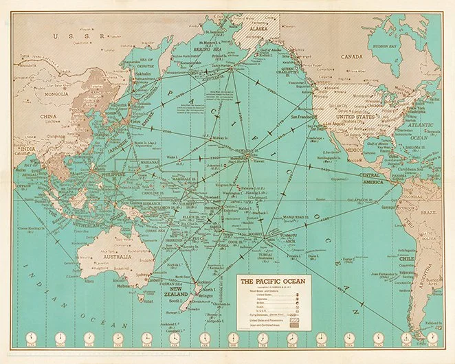
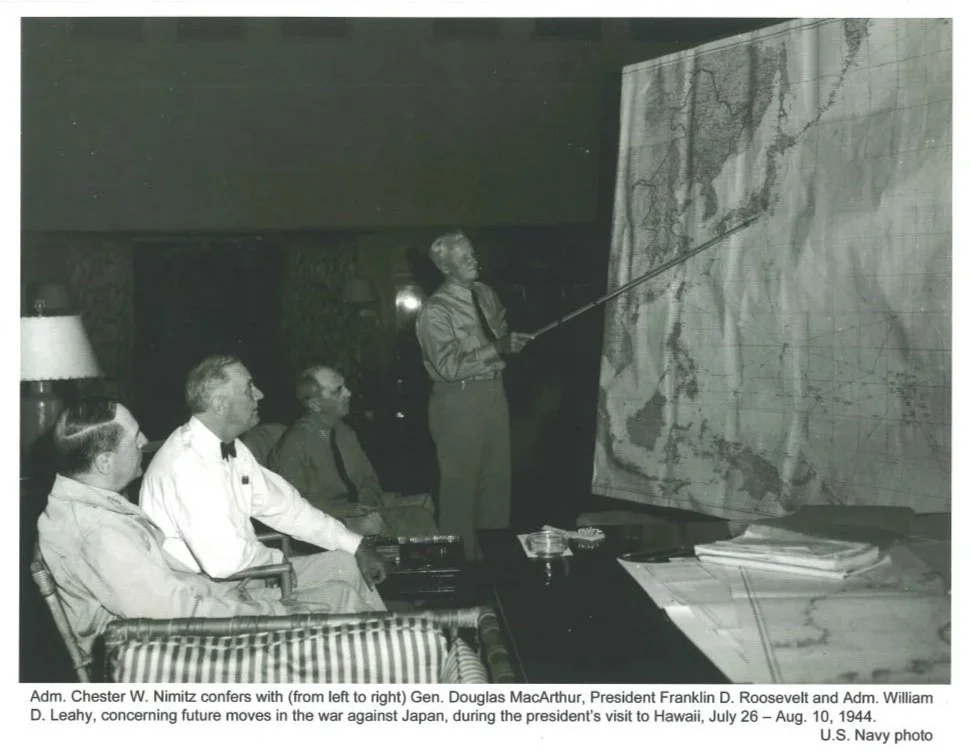
1942 Hammond War Map
1942 Hammond War Map – Drawn and published in response to the bombing of Pearl Harbor, this is one of the most detailed USA maps of the Pacific ever produced. McArthur’s “Hit em where they’re not” and “Island Hopping” campaigns could not be carried out until we knew where every island, atoll and knoll was located. The chart serves as a Pacific Theater “situation” map showing flight routes, distances and possessions as they existed at the beginning of the war.
This Pacific centric map demystifies the otherwise mysterious ocean. The Pacific is generally shown incomplete as an extension of the West Coast of North America, Oceanica, North and SE Asia, the Aleutians and the South Pacific. This complete map showing the whole Pacific and surrounding continents and island groupings is a valuable tool in understanding the strategic movement of troops and Pacific war strategies. Six smaller maps appear on the back side. The Navy has recently declassified and released the Nimitz Gray Book which documents the incidents of the Pacific Theater from Dec. 7, 1941, through the end of the war in 1945. This detailed map can be used to trace all of the military movement and battles of the Pacific Theater with great detail. View Gray Book at http://www.ibiblio.org/anrs/graybook.html
The original map measures 20 ½ x 27
Hawaii Ocean Battlefield Map. / ハワイ大海戦圖
Celebrating the Japanese victory at Pearl Harbor.
1941 (dated) | 14.5 x 20.5 in
Pearl Harbor Attack- by Artist Matsushima-1941-2
Descriptive text courtesy of Geographicus Rare Antique Maps
1942 Pearl Harbor Bombing Print Matsushima
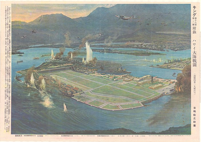
Name of Print in JP:
キング 第十八卷 第三號 附錄 ハワイ大海戰圖(海檢丙第二九號許可)
Name of Print in modern forms of Japanese kanji:
キング 第十八巻 第三号 附録 ハワイ大海戦図(海検丙第二九号許可)
Name of Print in EN:
Supplement to King, Vol. 18, No. 3 ̶ Map of the Great Naval Battle of Hawaii (Approved under Naval Censorship Permit No. 29, Class C)
Artist Name in JP:
古嶋松之助
Artist Name in EN:
Matsunosuke Furushima
Publish Date in JP:
大正十三年十一月二十日第三種郵便物認可(毎月一回一日發行)
昭和十七年二月十一日印刷納本 昭和十七年三月一日發行
Publish Date in EN:
Authorized as Third-Class Mail on November 20, 1924 (Published once a month on the first day of each month)
Printed and deposited on February 11, 1942; published on March 1, 1942
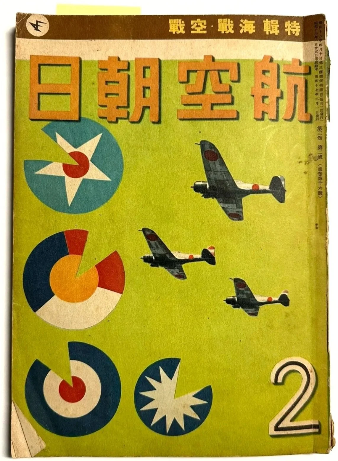
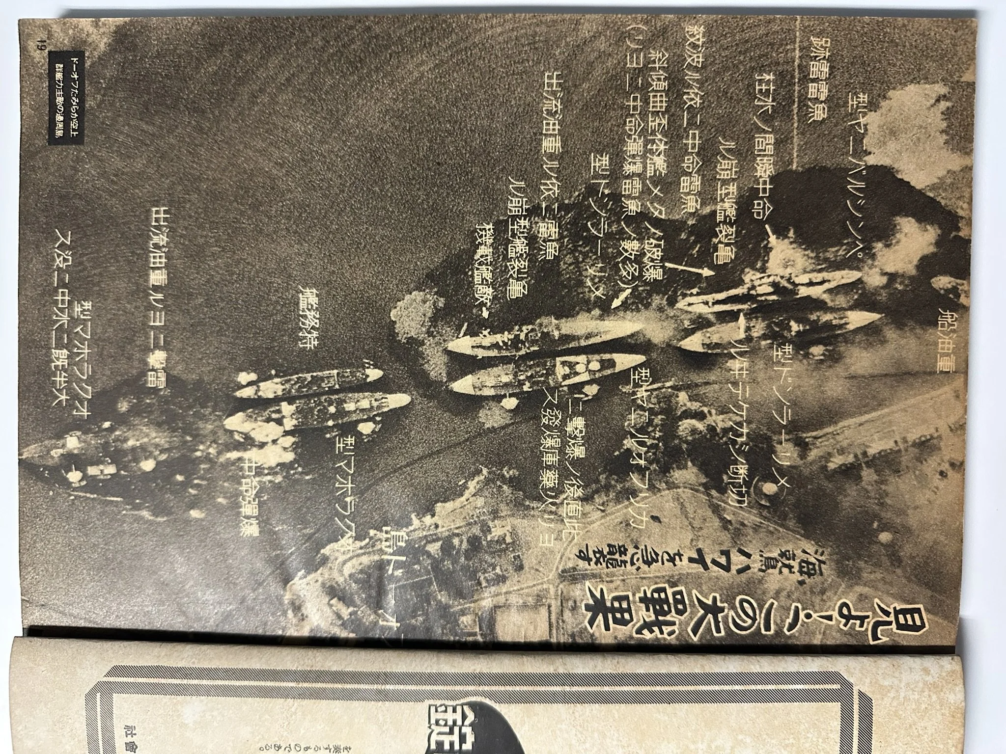
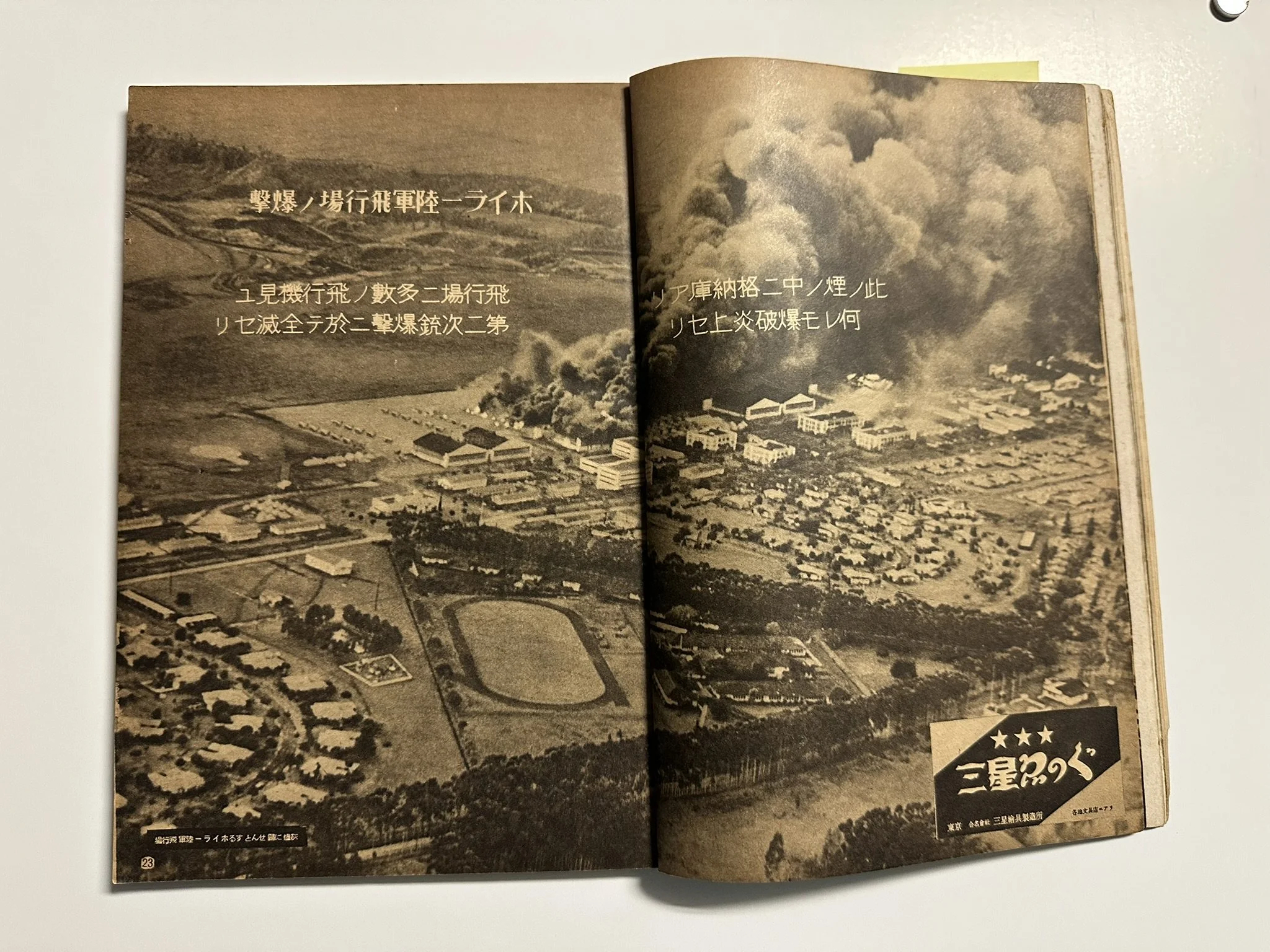
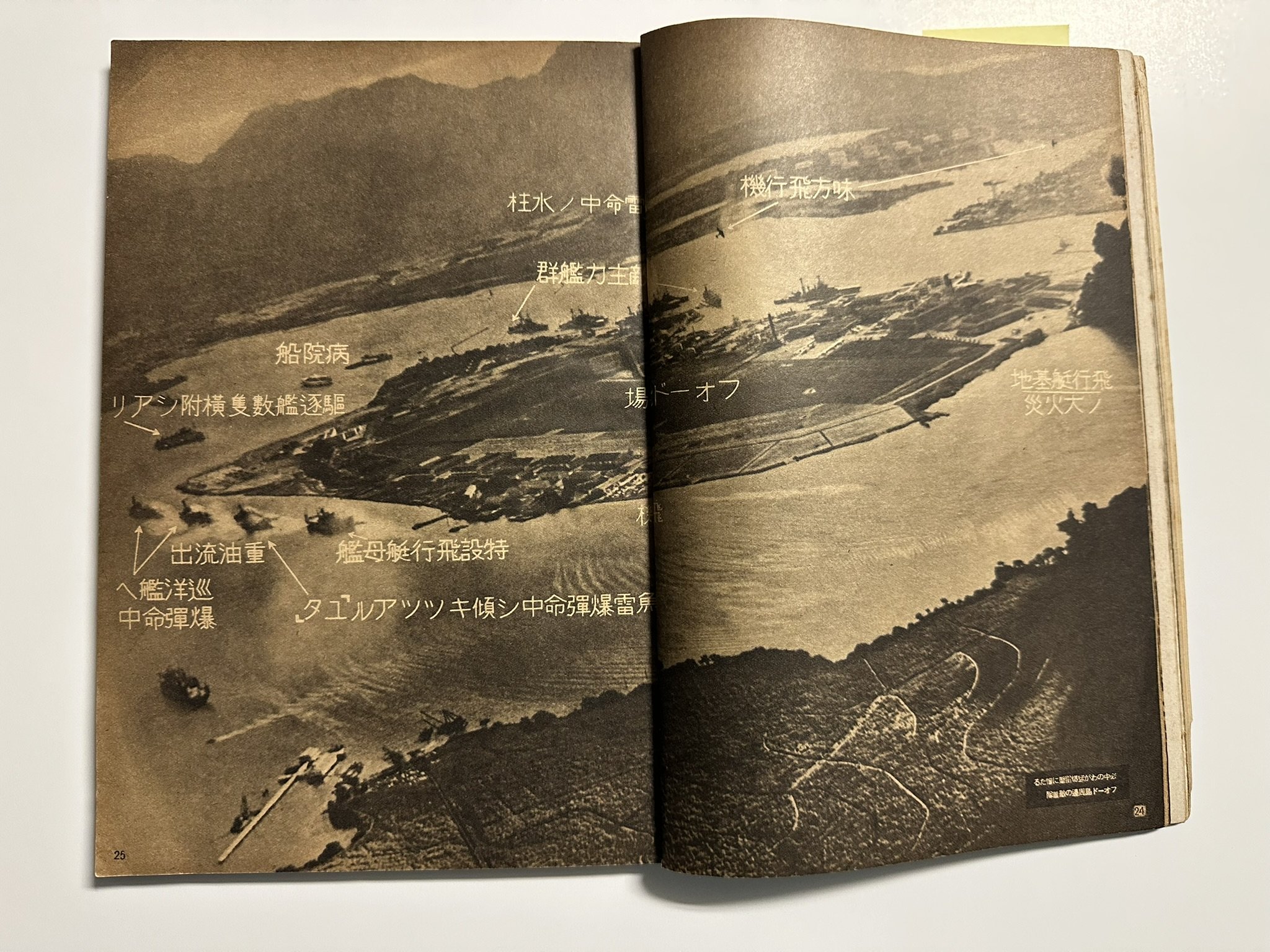
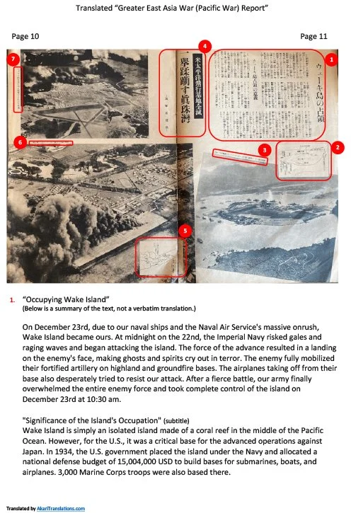
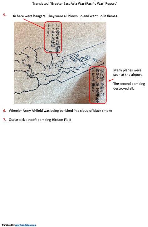
1942 Magazine Cover
and 5 Pages
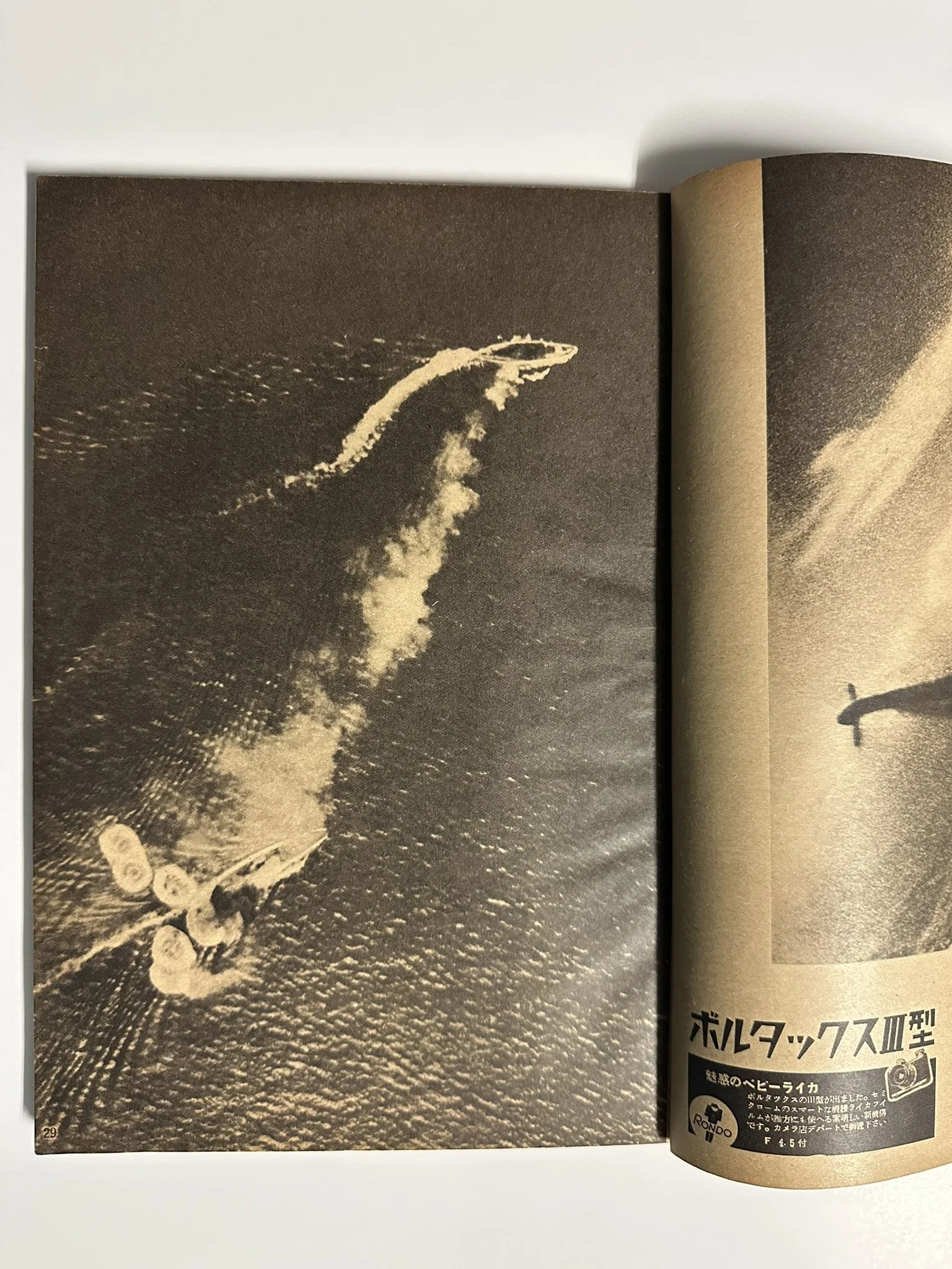
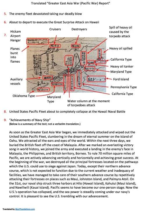
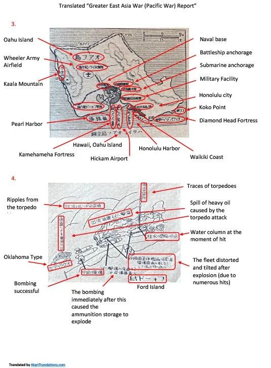
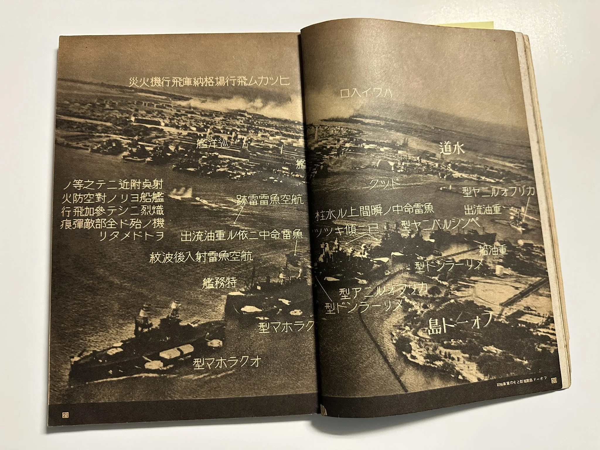
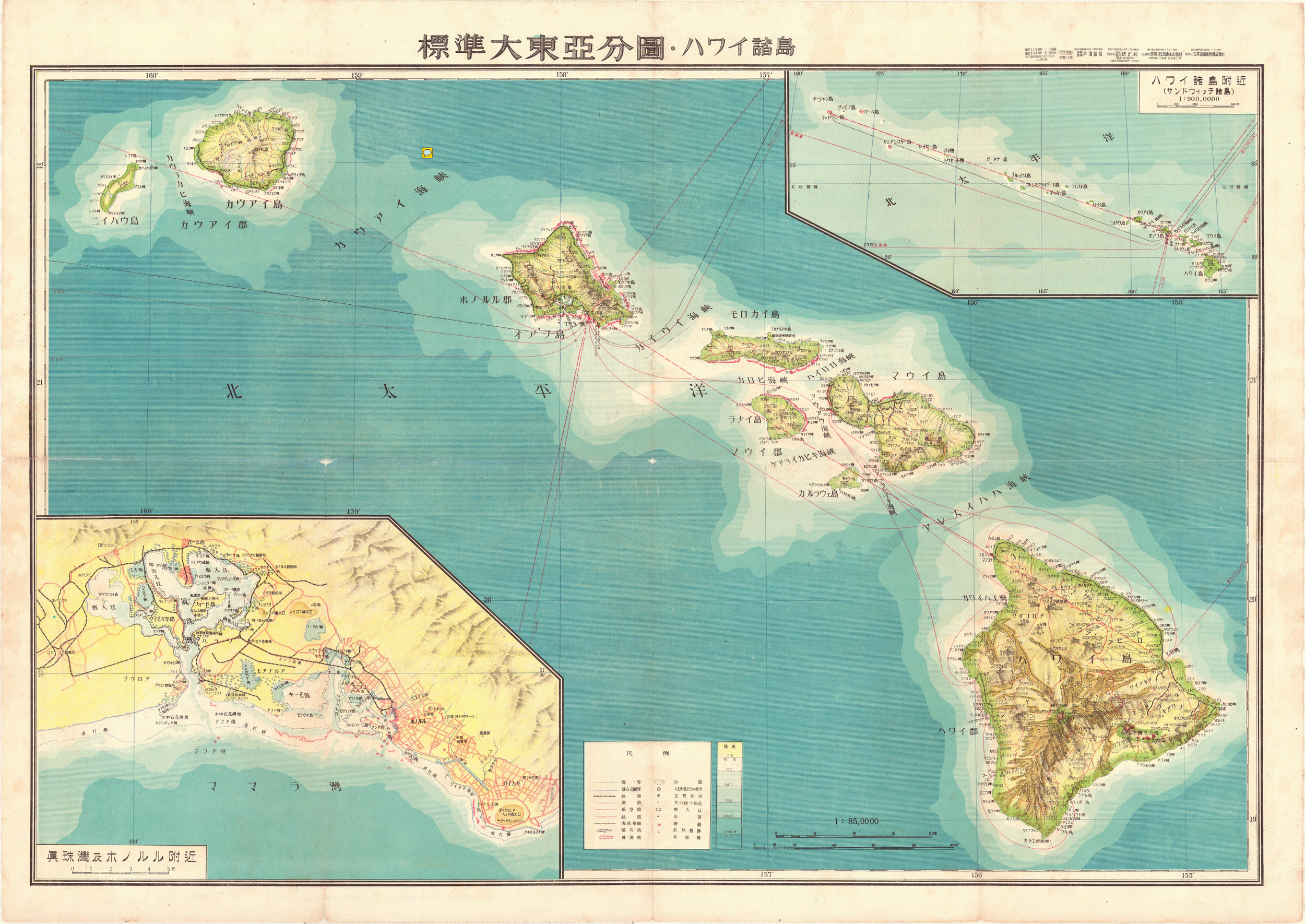
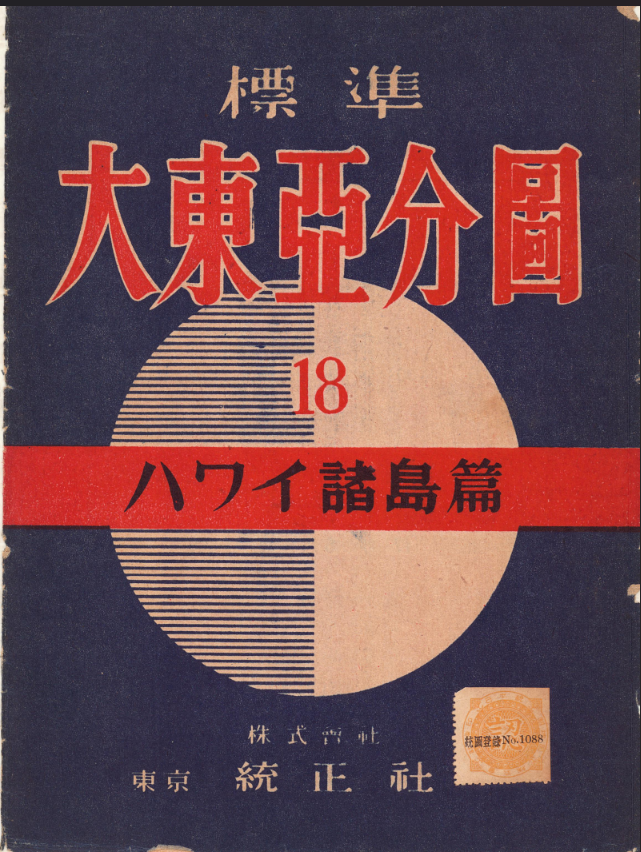
1943 - Standard Greater East Asia Partial Map
Hawaiian Archipelago
1This detailed map of Hawaii was originally published April 1, 1943, republished June 20, 1943. The insets show the Hawaiian archipelago and environs (Sandwich Archipelago), the eight major islands in the chain and a close up of Pearl Harbor and Honolulu environs. This is one of the last large-scale maps of Hawaii ever to be printed by the Japanese Empire.
The Greater East Asia Co-Prosperity Sphere (大東亞共榮圏 Dai-tō-a Kyōeiken) was an imperial propaganda concept created and promulgated for occupied Asian populations during the first third of the Shōwa era by the government and military of the Empire of Japan. It extended greater than East Asia and promoted the cultural and economic unity of Northeast Asians, Southeast Asians, and Oceanians. It also declared the intention to create a self-sufficient "bloc of Asian nations led by the Japanese and free of Western powers". It was announced in a radio address entitled "The International Situation and Japan's Position" by Foreign MinisterHachirō Arita on June 29, 1940.
As planned, The Greater East Asia Co-Prosperity sphere would include Hawaii, Howland Island, Baker Island the , Phoenix Islands, Rain Islands, Marquesas, Tuamotu Islands, Society Islands, Cook Islands , Austral Islands, all of the Samoan Islands, and Tonga.
The possibility of re-establishing the defunct Kingdom of Hawaii was also considered, based on the model of Manchukuo. Those favoring annexation of Hawaii (on the model of Karafuto) intended to use the local Japanese community, which had constituted 43% (c. 160,000) of Hawaii's population in the 1920s, as a leverage. Hawaii was to become self-sufficient in food production, while the Big Five corporations of sugar and pineapple processing were to be broken up. No decision was ever reached regarding whether Hawaii would be annexed to Japan, become a puppet kingdom, or be used as a bargaining chip for leverage against the U.S.


Greater East Asia
War Report Magazine
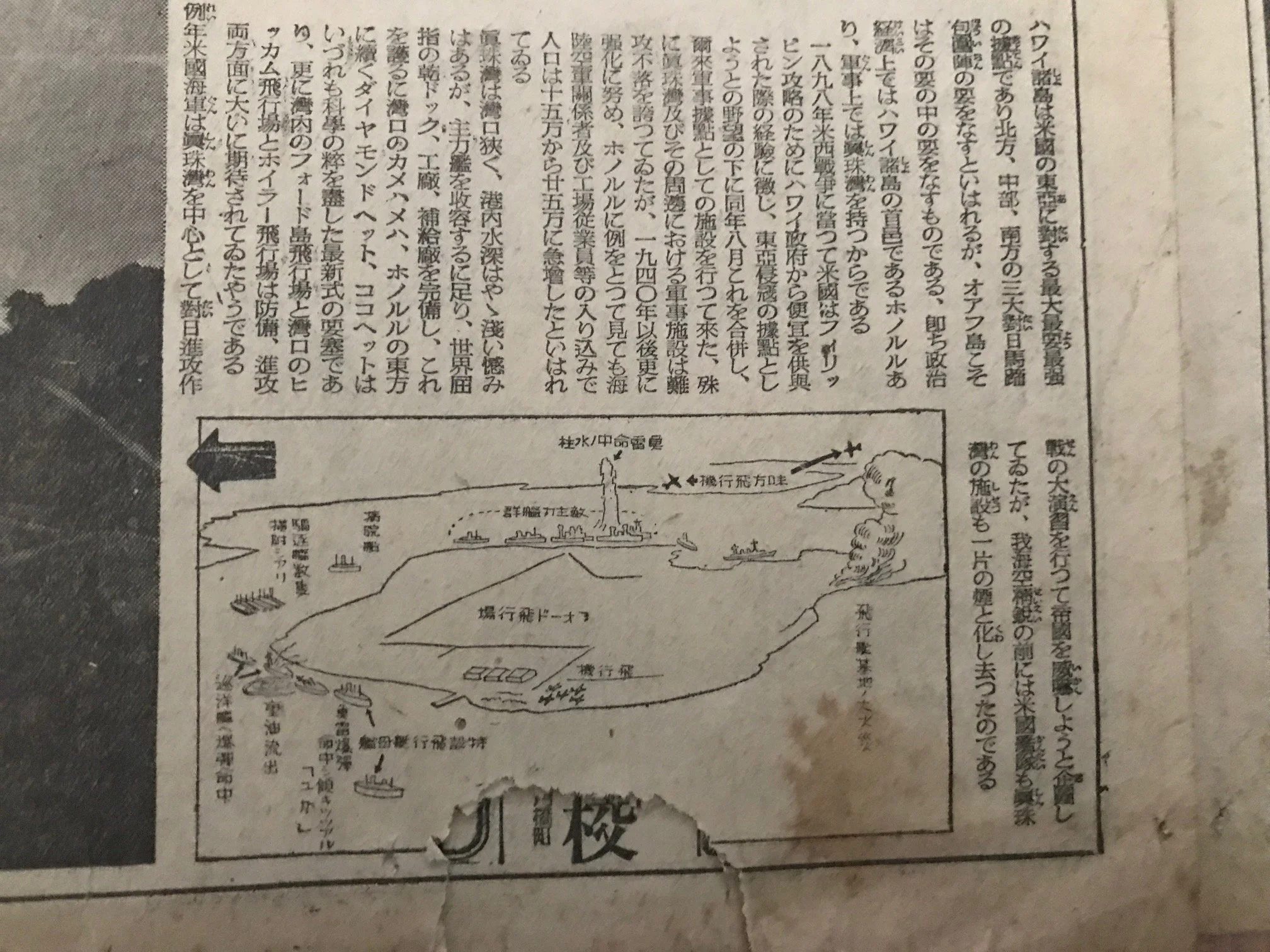
Newspapers
-
![A black and white historical newspaper featuring a large aerial photograph of a coastal city or harbor with buildings, water, and ships. Japanese text and headlines are visible, indicating it is from Japan.]()
Newspaper 1
-
![A page from a Japanese newspaper containing Japanese text along with diagrams and illustrations related to military or naval strategy.]()
Newspaper 2
-
![Black and white newspaper page featuring an aerial photograph of a landscape with buildings, roads, and a body of water. There is Japanese text beneath the image.]()
Newspaper 3
-
![Black and white newspaper photograph depicting a volcanic eruption with smoke and ash billowing into the sky, surrounding a small city or town with buildings, roads, and open fields.]()
Newspaper 4
-
![A black and white photograph of a Japanese newspaper article with text and a map illustration. The map appears to depict a military aircraft landing area, with labels and directional arrows, and a small drawing of a ship.]()
Newspaper 5
-
![Black and white photograph of a military jet aircraft flying low above the ground with Japanese text around it on a newspaper clipping.]()
Newspaper 6
-
![A black and white photograph of a historical military scene, featuring a large group of soldiers on the ground, a person in military uniform with a horse silhouette, and a high-altitude aircraft flying in the sky, on a Japanese newspaper page with Japanese text.]()
Newspaper 7
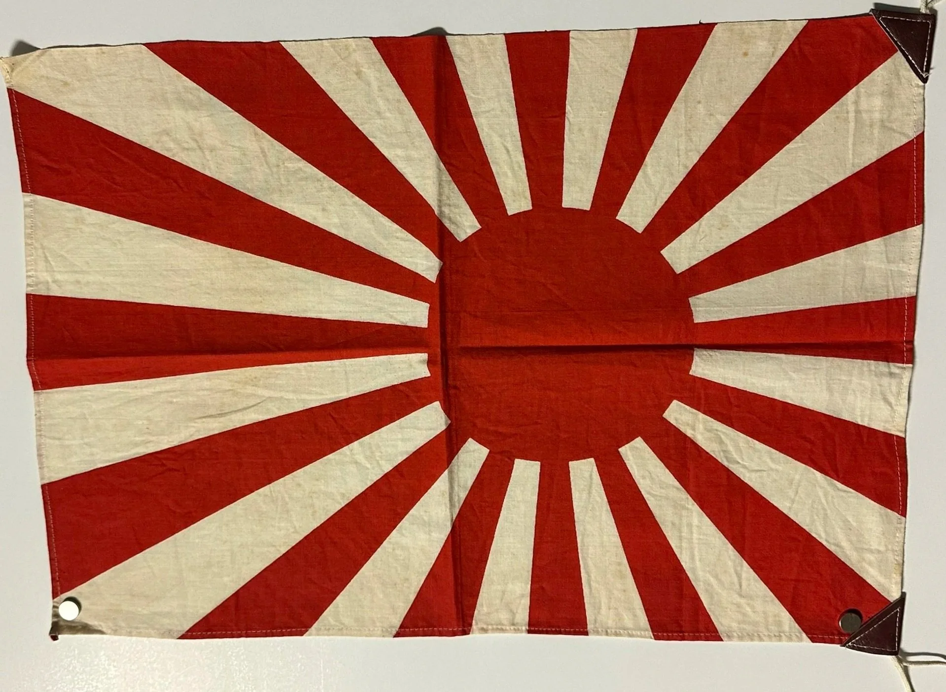
Japanese Flags
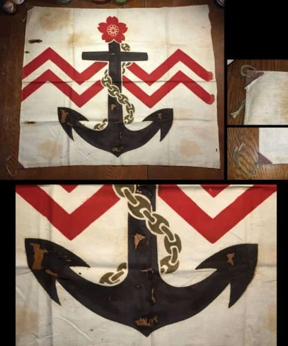
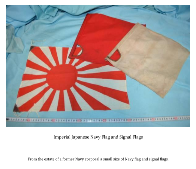
The Museum Collection Portfolio
Original Period Artifacts (For Purchase)
This curated collection features six authentic, original historical documents,
uniquely enhanced for exhibition display and educational analysis:
The occasion of the 85th anniversary of the attack on Pearl Harbor is the ideal opportunity to take a fresh and wider ranging view of events leading up to World War II and the role played by each nation in an exhibition that can be understood and appreciated not only by the generation that survived the war but its children, grand-children and great-grandchildren alive today.
The organizer of this exhibit - Bryant Neal - is a vintage map historian who first became interested in the Japanese side of the narrative two decades ago when he began to purchase and assemble original antique maps, photos, artifacts and other materials from the Japanese perspective that were either ignored or overlooked by others.
We envision an exhibit that is both real and virtual and sparks a dialog about the past, present and future that is international.
It is our goal to match artifacts with appropriate museums to be used as tools to help unfold the story of the bombing of Pearl Harbor.
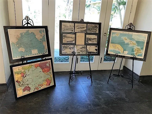
The curated “Museum” collection features a portfolio of 6 original artifacts and are available on loan and purchase.
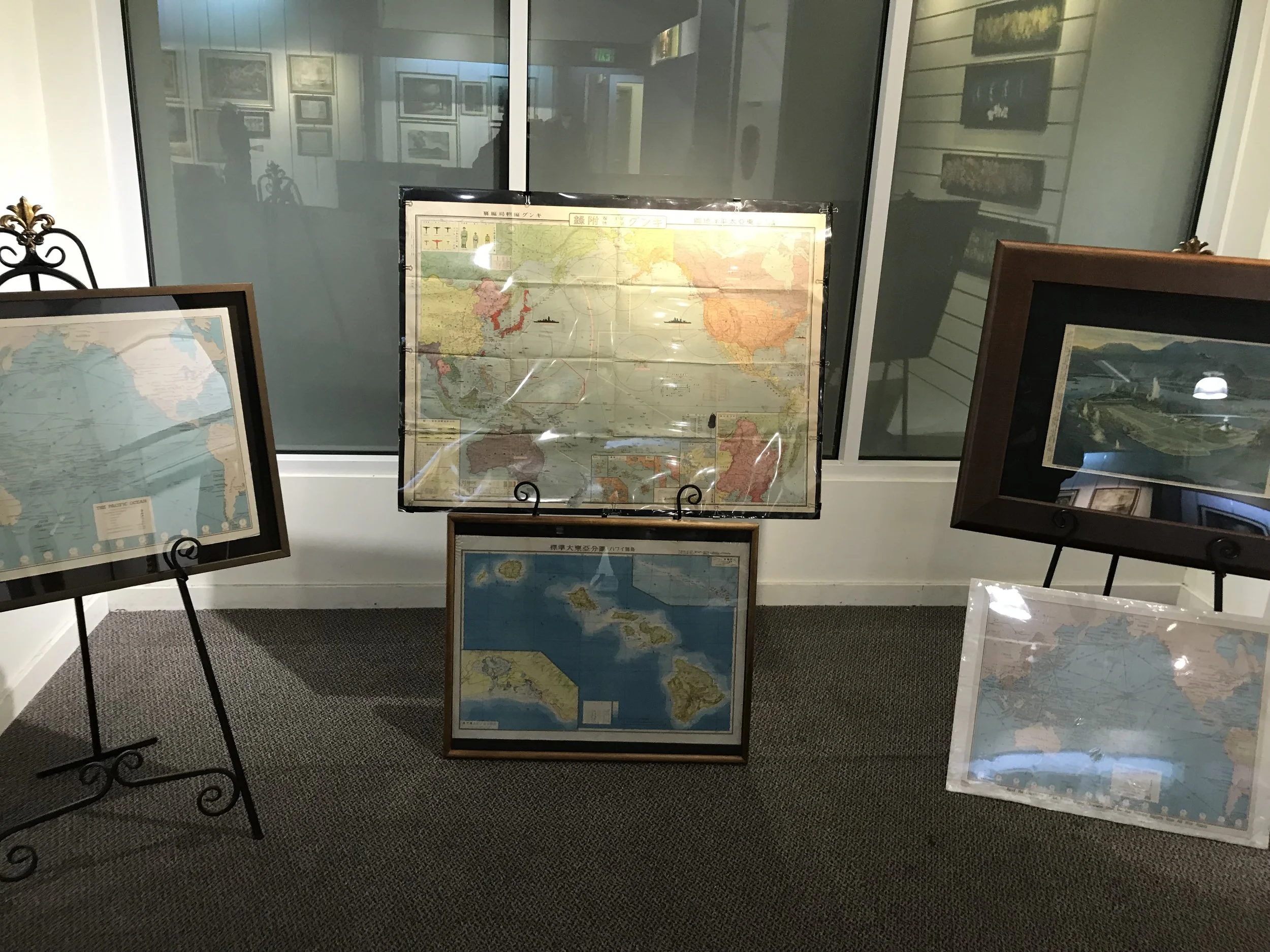
Special Museum Collection Acquisition & Educational Offer
The Road to Pearl Harbor: Original Cartographic Artifacts of the Pacific War
In commemoration of the upcoming 85th Observation of the Attack on Pearl Harbor, The Story of Hawaii Museum is offering an exclusive institutional acquisition package of rare, original period artifacts.
Every Japanese-language document in this collection has been fully and professionally translated into English, maintaining absolute historical accuracy while making them immediately accessible as primary-source teaching tools for your visitors, curators, and students.
-
Authentic pre-war original map. Fully translated.
Educational Focus: Pre-war Japanese naval positioning, trade routes, and early Pacific ambitions. Includes an exclusive companion archive of original press photos of Rep. Martin Dies Jr. presenting the map as a smoking gun in his address to Congress.
$2500 (Contact Curator)
-
Artifact Status: Authentic original pictorial map. Fully translated.
Educational Focus: The escalating Second Sino-Japanese War and regional propaganda shifts. Japan lays the foundation and justification for disputes with Russia and China.
$950 (Contact Curator)
-
Authentic wartime original document. Fully translated.
Educational Focus: Eight images featuring the actual tactical bombing sequence captured directly from Japanese planes during the attack, providing an unparalleled, timeline-based view of the strike.
$1500 (Contact Curator)
-
Authentic wartime original propaganda print
Educational Focus: Dramatic Japanese home front visual documentation and artistic rendering of the "Great Naval Battle of Hawaii” . Painting inspired from the attack photos.
$1800 (Contact Curator)
-
Original 1942 American-published folding map.
Educational Focus: Domestic American public perspective and how the home front tracked active Pacific theaters. One of the most detailed pacific centric maps of the war era. Press photo shows the map at the Honolulu Conference.
$350 (Contact Curator)
-
Authentic wartime Japanese-produced original map of Hawaii .
Educational Focus: The Japanese Empire's cartographic projection of its expanded borders and strategic intelligence gathering. A very detailed map of Hawaii with detailed insets of Pearl Harbor and Honolulu harbor.
$1500 (Contact Curator)
-
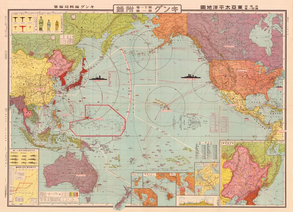
Item 1 - 1934 Map of East Asia Pacific (The Dies Committee Artifact)
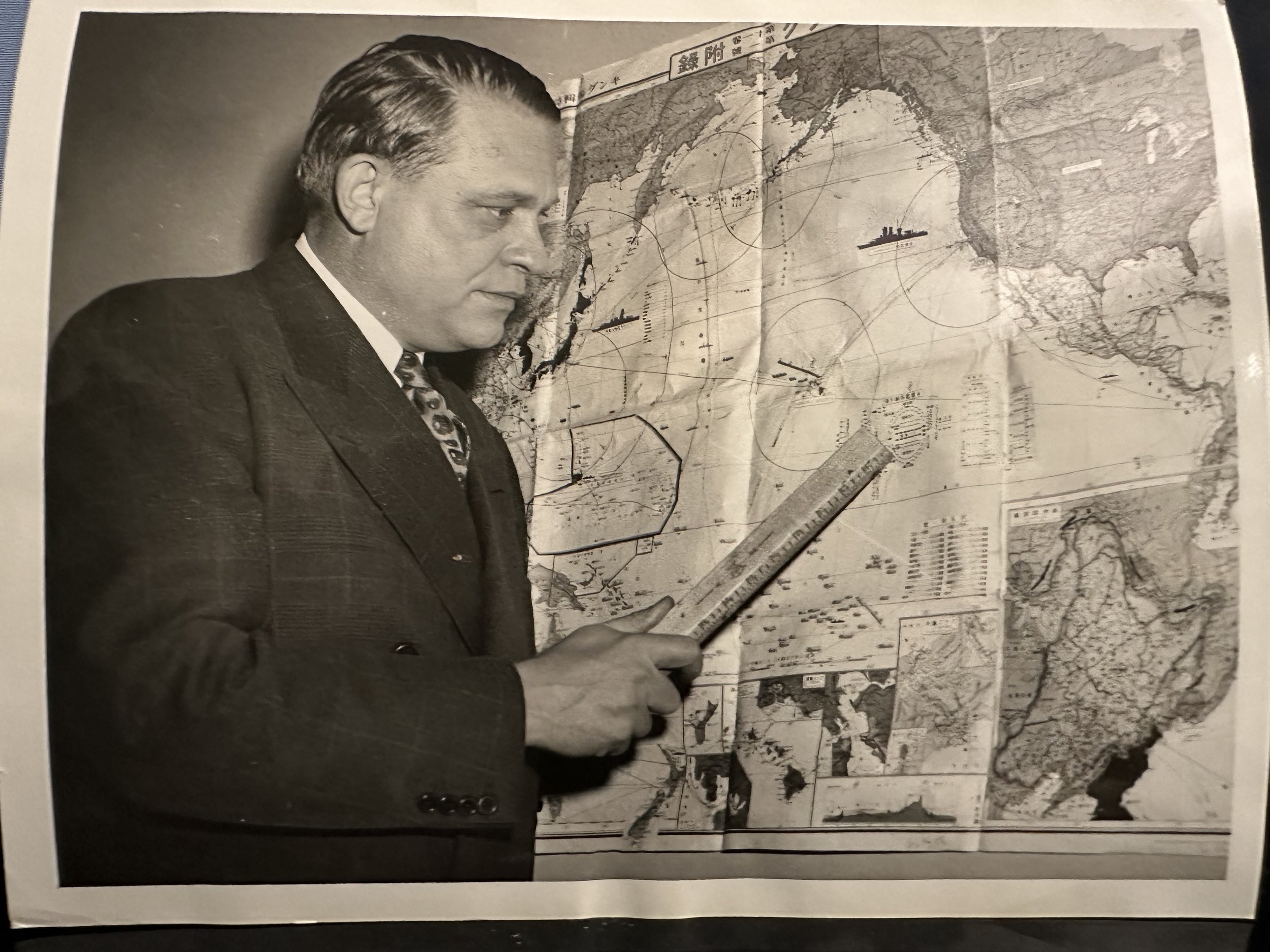
Item 1 - Press Photos showing representative Martin Dies viewing the 1934 map obtained under extraordinarily difficult circumstances.
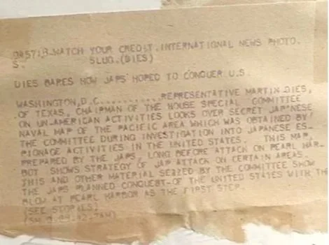
Item 1 - Dies Press photo #1 (Back)
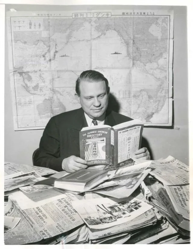
Item 1 - Press Photos showing representative Martin Dies viewing the 1934 map obtained under extraordinarily difficult circumstances.
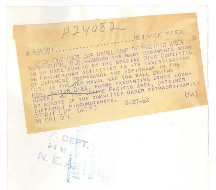
Item 1 - Dies Press Photo #2 (back)
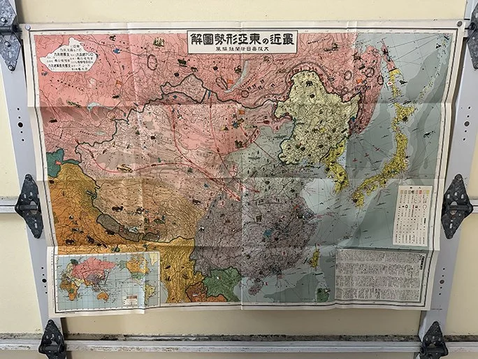
Item 2 - 1937 Illustration of the Recent East Asia State of Affairs Map
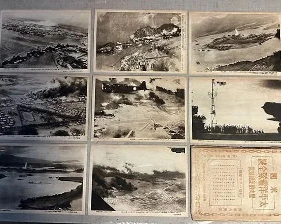
Item 3 - 1942 Historic Photographic Record of Complete Destruction of Entire American Pacific Fleet
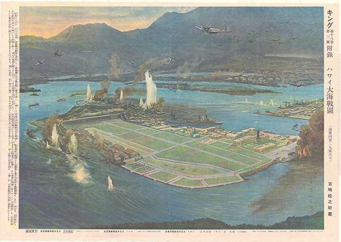
Item 4 - 1942 Pearl Harbor Bombing Print (Matsunosuke Furushima / "Matsumoto")
Item 5 - 1942 Hammond War Map
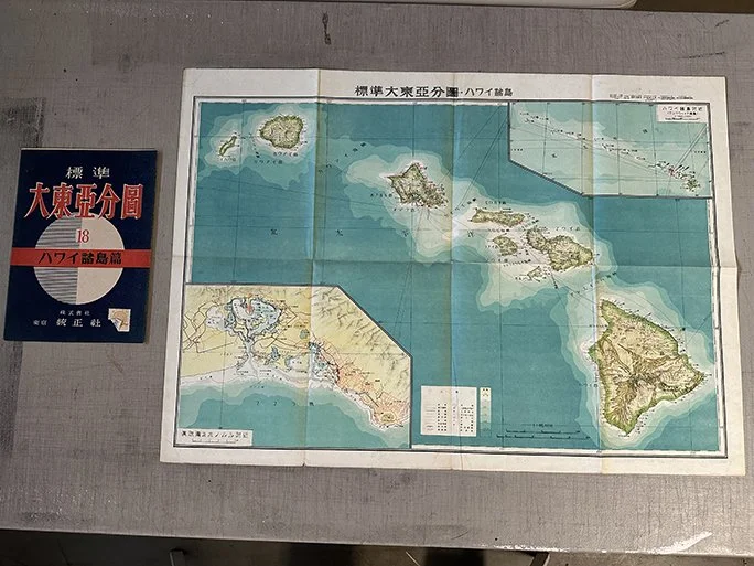
Item 6 - 1943 Standard Greater East Asia Partial Map: Hawaiian Archipelago