Story of Hawaii Museum
PREMIUM CANVAS & DIGITAL MEDIA PRINTS
japanese maps


1938 - Age: Showa era 13 (1938)
Publisher: Ministry of the Navy
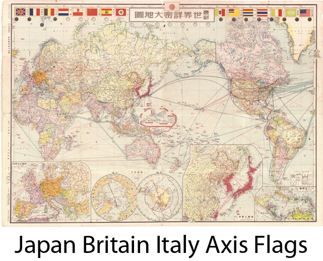
WW2 Japanese Navy Mapshowing World Fleet Warship deployment
Pictorial Zero Fighter 1938
1943 Japan published map of Hawaii
Greater East Asia Partial Map. Hawaiian Archipelago.
This detailed map of Hawaii was originally published April 1, 1943, republished June 20, 1943. The insets show the Hawaiian archipelago and environs (Sandwich Archipelago), the eight major islands in the chain and a close up of Pearl Harbor and Honolulu environs.
The Greater East Asia Co-Prosperity Sphere (大東亞共榮圏 Dai-tō-a Kyōeiken) was an imperial propaganda concept created and promulgated for occupied Asian populations during the first third of the Shōwa era by the government and military of the Empire of Japan. It extended greater than East Asia and promoted the cultural and economic unity of Northeast Asians, Southeast Asians, and Oceanians. It also declared the intention to create a self-sufficient "bloc of Asian nations led by the Japanese and free of Western powers". It was announced in a radio address entitled "The International Situation and Japan's Position" by Foreign Minister Hachirō Arita on June 29, 1940.
As planned, The Greater East Asia Co-Prosperity sphere would include Hawaii, Howland Island, Baker Island the , Phoenix Islands, Rain Islands, Marquesas, Tuamotu Islands, Society Islands, Cook Islands , Austral Islands, all of the Samoan Islands, and Tonga.
The possibility of re-establishing the defunct Kingdom of Hawaii was also considered, based on the model of Manchukuo. Those favoring annexation of Hawaii (on the model of Karafuto) intended to use the local Japanese community, which had constituted 43% (c. 160,000) of Hawaii's population in the 1920s, as a leverage. Hawaii was to become self-sufficient in food production, while the Big Five corporations of sugar and pineapple processing were to be broken up. No decision was ever reached regarding whether Hawaii would be annexed to Japan, become a puppet kingdom, or be used as a bargaining chip for leverage against the U.S.
This is one of the last large scale maps of Hawaii ever to be printed by the Japanese Empire
Manchurian Incident Map
This important charttitled “ Night of September 18, Battle Summary Near North Garrison’ was published by the Kwangtung Army HQ and printed by the South Manchurian Printing Co. The map measures 15 ¼ x 21 ½
The Mukden Incident, or Manchurian Incident, was a staged event engineered by rogue Japanese military personnel as a pretext for the Japanese invasion in 1931 of northeastern China, known as Manchuria. This incident was similar in impact to China as the bombing of Pearl Harbor was to the USA. Uninvited attacks that led to further confrontation and war.
On September 18, 1931, Lt. Suemori Kawamoto detonated a small quantity of dynamite close to a railway line owned by Japan's South Manchuria Railway near Mukden (now Shenyang). The explosion was so weak that it failed to destroy the track and a train passed over it minutes later, but the Imperial Japanese Army accused Chinese dissidents of the act and responded with a full invasion that led to the occupation of Manchuria, in which Japan established its puppet state of Manchukuo six months later.
Map translations:
North Garrison located right below the title. Scale 1:10,000
Japanese Soldiers approximately 600; Chinese soldiers approximately 8,000 – 10,000 near the North Garrison.
Top left description:
Red ink – Japanese soldiers position and movement
Blue ink – Chinese soldiers position and movement
Red Cross at mid bottom is the exact location of railway explosion done by the Chinese
BOTTOM RIGHT: inset of Mukden City,