1942 PANORAMA MAP OF SOUTHERN RESOURCES
ORIGINAL
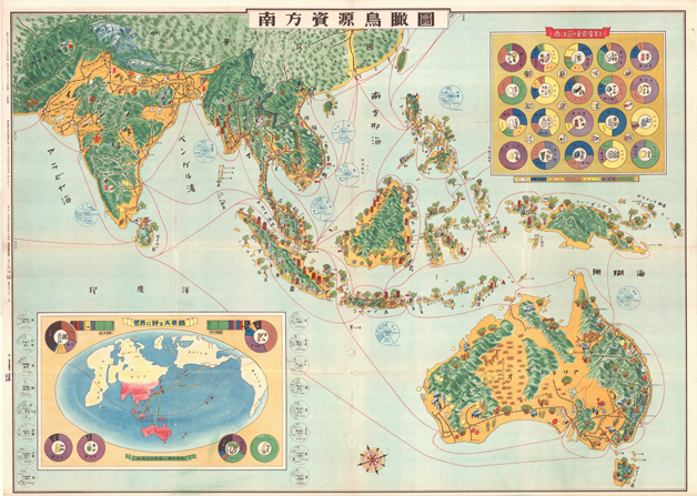
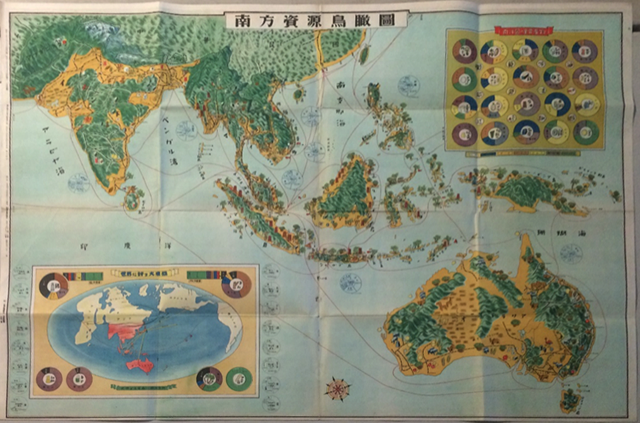
This map, published by Mr, HASHIMOTO in Tokyo for a private distributor, the Union Press Photo Bureau, shows the areas and the resources needed by Japan for basic survival and where they were located. The Dutch East Indes would be essential for much needed oil, while French Indo China would serve as a very important source as well. The Greater East Asia Co-Prosperity Sphere would be the method used to acquire these resources from neighboring countries.
Printed August 13, published August 18, 1942 ( Showa 17)
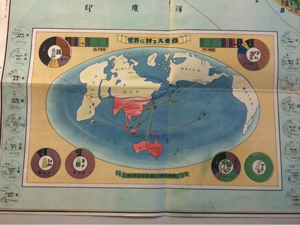
Translation of inset box in the upper right corner:
Top Line left to right: Coconut oil, cotton, rice, sugar, tea
Second row; chrome, tungsten, iron, magnesium, bauxite
Third row: industrial salt, nickel, oil, zinc, lead
Bottom line left to right; Sulfar, phosphate, coal, silver, gold
Map measures 30 x 42
Click here for reproduction.
This map, published by Mr, HASHIMOTO in Tokyo for a private distributor, the Union Press Photo Bureau, shows the areas and the resources needed by Japan for basic survival and where they were located. The Dutch East Indes would be essential for much needed oil, while French Indo China would serve as a very important source as well. The Greater East Asia Co-Prosperity Sphere would be the method used to acquire these resources from neighboring countries.
Printed August 13, published August 18, 1942 ( Showa 17)
Translation of inset box in the upper right corner:
Top Line left to right: Coconut oil, cotton, rice, sugar, tea
Second row; chrome, tungsten, iron, magnesium, bauxite
Third row: industrial salt, nickel, oil, zinc, lead
Bottom line left to right; Sulfar, phosphate, coal, silver, gold
Map measures 30 x 42