1941 DETAILED MAP OF THE PACIFIC OCEAN ON SCROLL
ORIGINAL
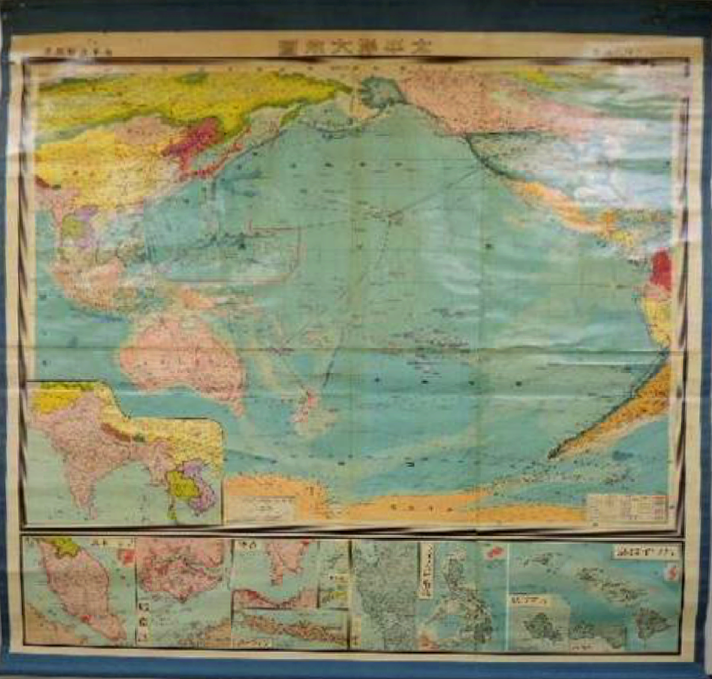
1941 DETAILED MAP OF THE PACIFIC OCEAN ON SCROLL
$1,900.00
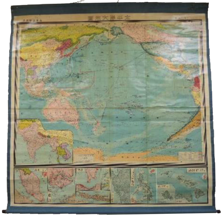
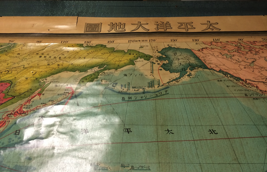
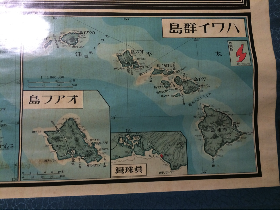
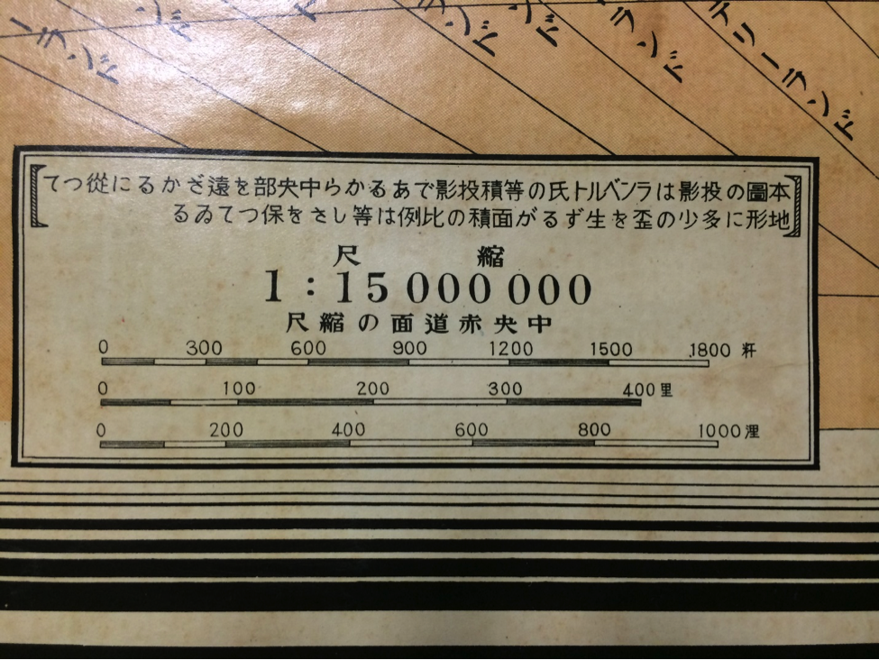
1941 large Pacific Ocean map published for the Kizaki Ryuo national policy implementation Study Group.
Issued Sep. 08, 1941 - 3 months before the Pearl Harbor Attack.
Map is attached on 60" x 61" scroll.
Condition is good with some slight tears .
Map is rare due to size and significant publish date.
No reproductions available.
No reproductions available.
1941 large Pacific Ocean map published for the Kizaki Ryuo national policy implementation Study Group.
Issued Sep. 08, 1941 - 3 months before the Pearl Harbor Attack.
Map is attached on 60" x 61" scroll.
Condition is good with some slight tears .
Map is rare due to size and significant publish date.