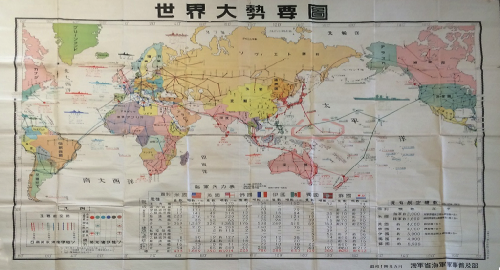
1939 ILLUSTRATED WORLD SITUATION SUMMARY MAP

ORIGINAL
$6,500.00
No reproductions available.
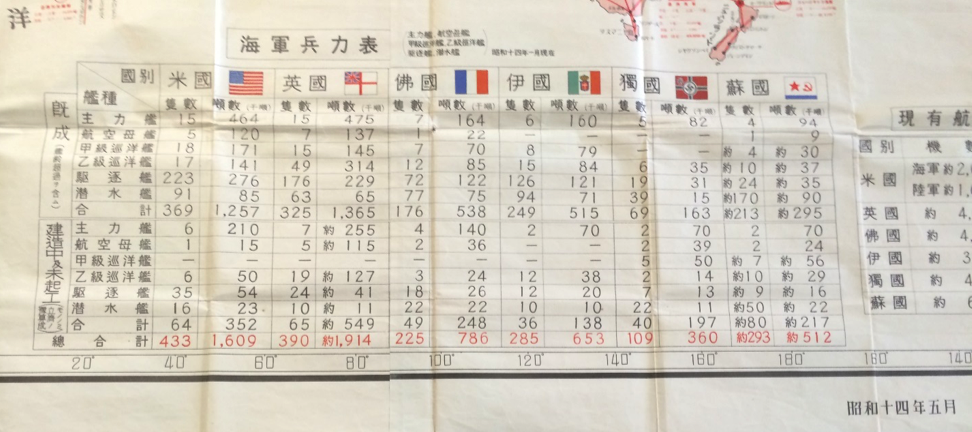
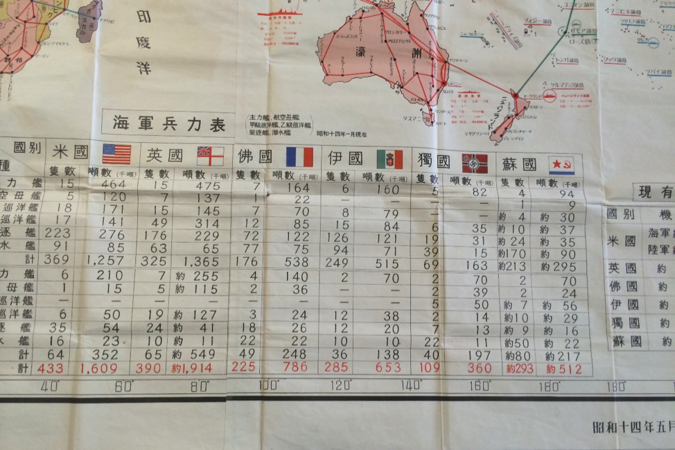
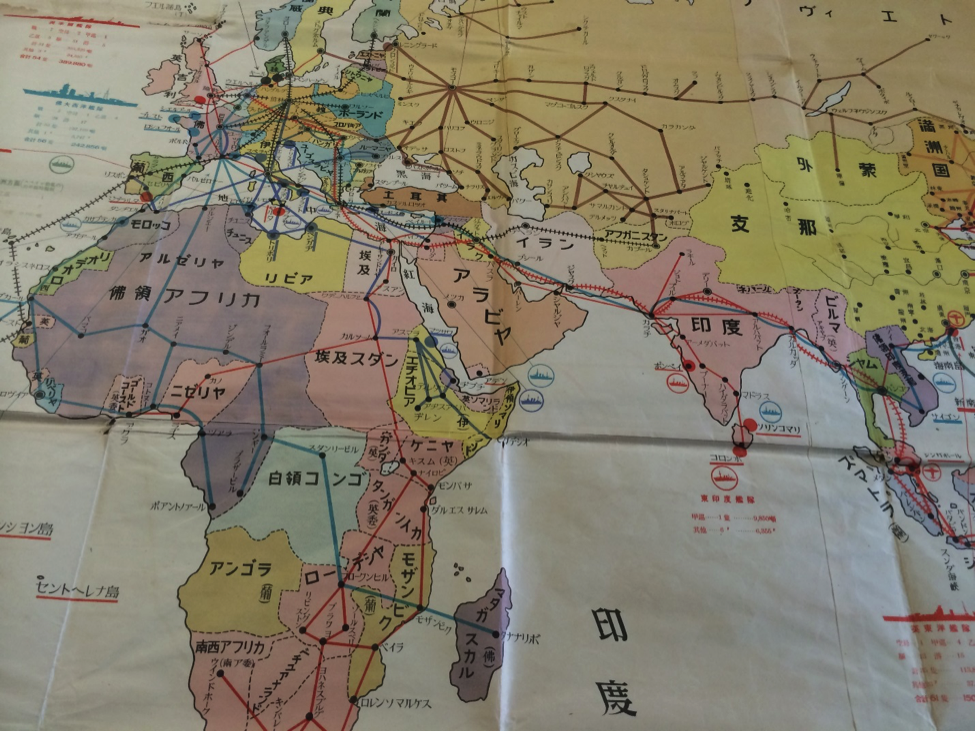
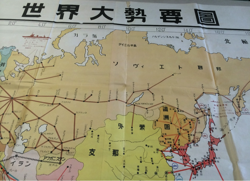
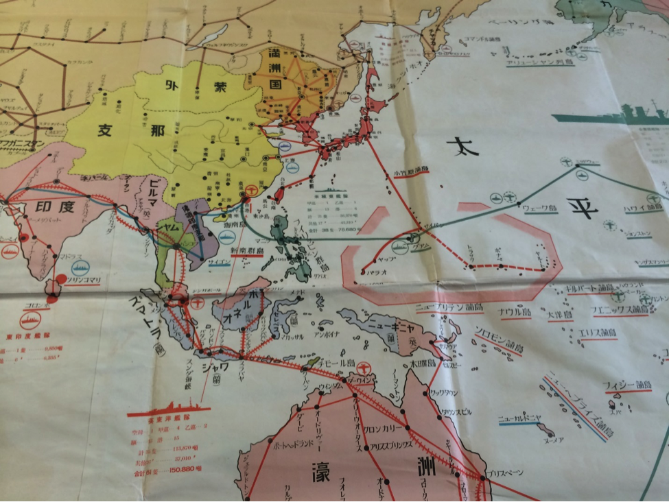
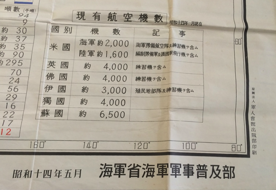
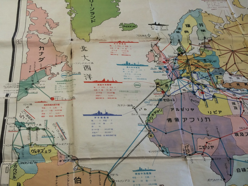
Published May 1939 by Ministry Of Navy, Division of Naval Knowledge Diffusion . The map measures 58 x 78 inches- Shows Table of Naval Powers with flags represented USA, UK, France, Italy, Germany, and the USSR.
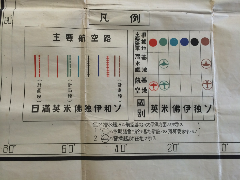
Aviation routes bottom left inset of Japan, Manchuria, UK, USA, France, Germany, Italy
Naval bases; UK, USA, France, Italy, Germany, USSR
The map has pencil markings on the back noting mathematical calculations.